If you have any questions, you are always welcome to contact us. We'll get back to you as soon as possible, withing 24 hours on weekdays.
Customer service
All questions about your order, return and delivery must be sent to our customer service team by e-mail at yourstore@yourdomain.com
Sale & Press
If you are interested in selling our products, need more information about our brand or wish to make a collaboration, please contact us at press@yourdomain.com
Help
If you have any questions, you are always welcome to contact us. We'll get back to you as soon as possible, withing 24 hours on weekdays.
Customer service
All questions about your order, return and delivery must be sent to our customer service team by e-mail at yourstore@yourdomain.com
Sale & Press
If you are interested in selling our products, need more information about our brand or wish to make a collaboration, please contact us at press@yourdomain.com
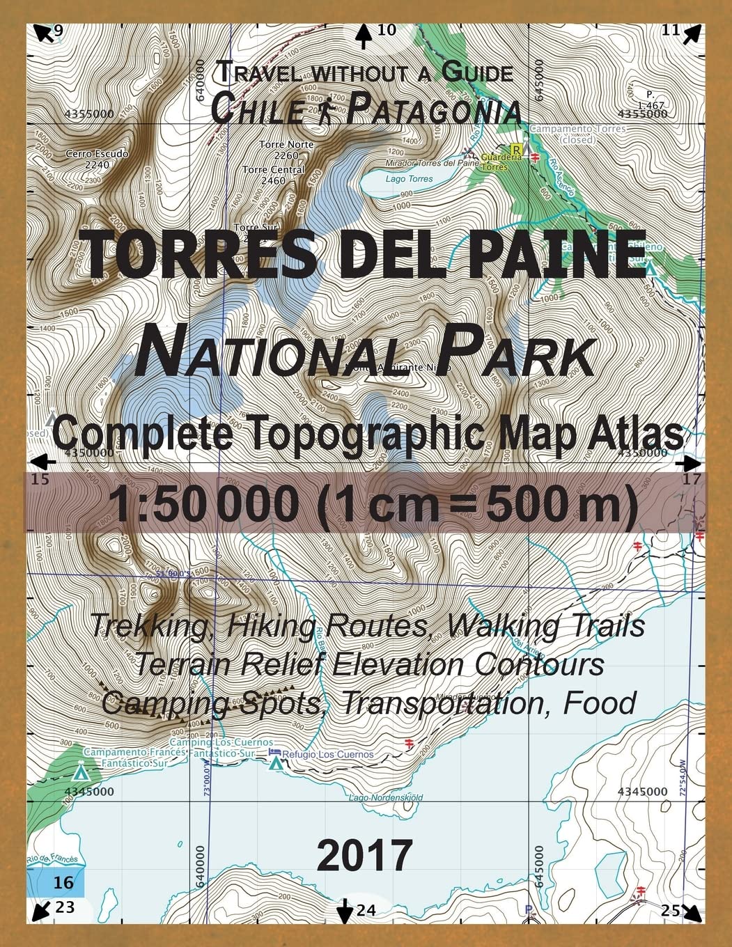
This detailed, full color Topographic Atlas represents the full area of the famous Torres del Paine National Park in Chilean Patagonia. Access to trails, availability of camping areas and special requirements such as obligatory walking direction on some sections, all have been updated for this edition according to the official 2017 regulations. The atlas maps show the full area of the park with access roads and adjacent areas, with alternative paths, camp sites (colorcoded according to the managing company), location of bus stops & park rangers' posts, all in large scale detail. Terrain relief elevation contours are drawn every 20 meters.The map scale of 1:50000 (1 cm = 500 meters) provides a wealth of detail while keeping low the weight of the atlas itself. The large page format of 8.5x11in minimizes page count and along with the overlapping map design allows for comfortable navigation. The details included in the topographic maps of this Atlas were specifically selected to be useful for trekkers, hikers and walkers of all interests, and make it easy to plan and enjoy both short excursions and hikes as well as long multiday adventures along the main marked routes and/or adjacent trails and paths, which are also shown on the maps. Bend this ultralight atlas in half, stuff it in the side pocket of your backpack, and you will always have a detailed, reliable, informationrich, batteryindependent, shatterproof map for your adventure.Mercator projection SAD69 with both UTM and WGS84 coordinate grids.
⚠️ WARNING (California Proposition 65):
This product may contain chemicals known to the State of California to cause cancer,
birth defects, or other reproductive harm.
For MAP (Minimum Advertised Price) violations and Intellectual Property (IP) or Trademark concerns, please contact:
support@ergodebooks.com
⚠️ California Proposition 65 Warning: Some products sold on this website may expose you to chemicals known to the State of California to cause cancer, birth defects, or other reproductive harm. For more information, visit www.P65Warnings.ca.gov.