
Title

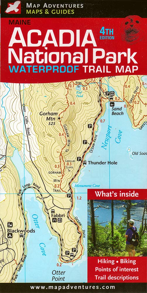
Acadia National Park Waterproof Trail Map, Maine
Sold by Ergodebooks, an authorized reseller.
Returns accepted within 30 days | support@ergodebooks.com
Shipping Information
- Free Standard Shipping — United States only
- Processing Time: 3–5 business days
- Estimated Delivery: 6–10 business days after dispatch
- Double-boxed, fully insured & discreetly packaged
- Tracking number sent via email once dispatched
Returns & Refund
Returns accepted within 30 days of delivery.
Damaged or Defective Item
Free return shipping + replacement or full refund
Wrong Item Received
Free return shipping + replacement or full refund
Change of Mind
Return shipping at customer's expense · 25% restocking fee applies
Payment Option

Fourth Edition Revised In 2019.Printed On Durable, Waterproof Material To 1:22500 Scale And, Contour Lines, Mileage Indicators Between Points Of Interest, It Is A Perfect Companion For Hikers And Visitors To The Acadia National Park And Seashores. Hiking And Cycling Trails Are Distinctivaly Marked, Making It Easy To Stay Found. This Map Was Designed And Published By Regional Residents, And A Portion Of The Proceeds From Sales Of This Maps Is Donated To Organizations That Support Trails Maintenace And Land Conservation.
⚠️ WARNING (California Proposition 65):
This product may contain chemicals known to the State of California to cause cancer, birth defects, or other reproductive harm.
For more information, please visit www.P65Warnings.ca.gov.
- Q: What are the dimensions of the Acadia National Park Waterproof Trail Map? A: The dimensions are eight inches by three point nine inches by zero point three inches. This compact size makes it easy to carry while hiking.
- Q: What material is the Acadia National Park Trail Map made from? A: The map is printed on durable, waterproof material. This ensures longevity and protection against the elements during outdoor activities.
- Q: How many pages does the Acadia National Park Trail Map have? A: The map does not have pages as it is a single folding map. It includes detailed trails and points of interest for hikers.
- Q: How do I use the Acadia National Park Trail Map? A: You can use the map by following the marked hiking and cycling trails. It provides mileage indicators between points of interest for easy navigation.
- Q: Is the Acadia National Park Trail Map suitable for beginners? A: Yes, the map is suitable for beginners. Its clear markings make it easy for anyone to follow the trails in Acadia National Park.
- Q: Can I use the Acadia National Park Trail Map for cycling? A: Yes, the map is designed for both hiking and cycling trails. It distinctly marks the trails suitable for cyclists.
- Q: How should I care for the Acadia National Park Trail Map? A: To care for the map, keep it dry and store it flat to avoid creasing. The waterproof material allows for easy cleaning if it gets dirty.
- Q: Is the Acadia National Park Trail Map safe to use in wet conditions? A: Yes, the map is waterproof. This feature allows it to withstand wet conditions, making it reliable during rainy hikes.
- Q: How do I store the Acadia National Park Trail Map? A: Store the map flat in a dry place. Avoid folding it excessively to maintain its condition and readability.
- Q: What type of trails does the Acadia National Park Trail Map cover? A: The map covers hiking and cycling trails in Acadia National Park. It highlights various points of interest along these trails.
- Q: Is the Acadia National Park Trail Map suitable for children? A: Yes, the map is suitable for children. It provides clear directions and is a great educational tool for learning about the park.
- Q: What features make the Acadia National Park Trail Map unique? A: The map features contour lines and mileage indicators between points of interest. It is designed by regional residents for accuracy.
- Q: Does the Acadia National Park Trail Map support conservation efforts? A: Yes, a portion of the proceeds from sales is donated to organizations that support trail maintenance and land conservation.
- Q: Who designed the Acadia National Park Trail Map? A: The map was designed and published by regional residents. Their local knowledge contributes to its detailed and accurate representation.
- Q: What is the scale of the Acadia National Park Trail Map? A: The map is printed to a scale of one to twenty-two thousand five hundred. This scale provides detailed topographical information for hikers.