
Title
Antarctica Map Guide,New
Sold by Ergodebooks, an authorized reseller.
Returns accepted within 30 days | support@ergodebooks.com
Shipping Information
- Free Standard Shipping — United States only
- Processing Time: 3–5 business days
- Estimated Delivery: 6–10 business days after dispatch
- Double-boxed, fully insured & discreetly packaged
- Tracking number sent via email once dispatched
Returns & Refund
Returns accepted within 30 days of delivery.
Damaged or Defective Item
Free return shipping + replacement or full refund
Wrong Item Received
Free return shipping + replacement or full refund
Change of Mind
Return shipping at customer's expense · 25% restocking fee applies
Payment Option

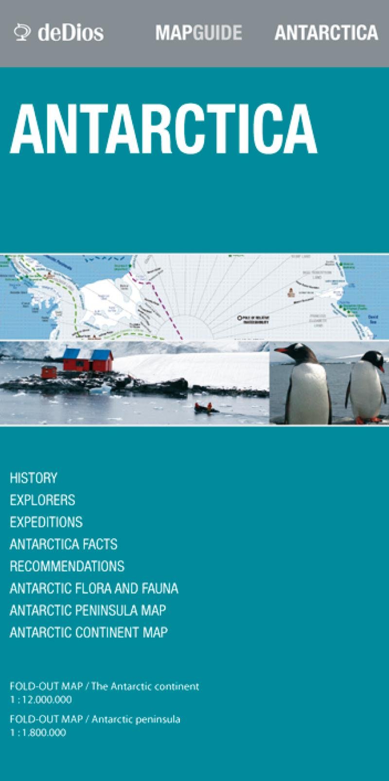
Folded Map Guide. Scale 1:12,000,000/1:1,800,000. Side 1 Shows A Map Of The Antarctic Continent, Its History, Explorers And An Inset Map Of The Antarctic Treaty. Side 2 Shows A Map Of The Antarctic Peninsula, Deception Island, The Danco Coast And Information On The Birds/Mammals/Fish And Plants Found On Antarctica.
⚠️ WARNING (California Proposition 65):
This product may contain chemicals known to the State of California to cause cancer, birth defects, or other reproductive harm.
For more information, please visit www.P65Warnings.ca.gov.
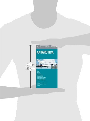
- Q: What are the dimensions of the Antarctica Map Guide? A: The Antarctica Map Guide has dimensions of nine point thirteen inches in length, four point eight inches in width, and zero point twenty-four inches in height. This compact size makes it easy to carry while traveling.
- Q: How many pages does the Antarctica Map Guide have? A: The Antarctica Map Guide contains two pages. One side features a map of the Antarctic continent and the other a map of the Antarctic Peninsula.
- Q: What type of binding does the Antarctica Map Guide have? A: The Antarctica Map Guide is bound as a map. This allows for easy unfolding and reference during your travels.
- Q: How do I use the Antarctica Map Guide effectively? A: To use the Antarctica Map Guide, simply unfold it to view the maps and information. It provides detailed geographic and historical context, making it ideal for travelers and explorers.
- Q: Is the Antarctica Map Guide suitable for educational purposes? A: Yes, the Antarctica Map Guide is suitable for educational purposes. It includes historical information about explorers and the Antarctic treaty, making it a valuable resource.
- Q: Can I take the Antarctica Map Guide on a hike? A: Yes, you can take the Antarctica Map Guide on a hike. Its folded design makes it portable and easy to carry.
- Q: How should I store the Antarctica Map Guide? A: You should store the Antarctica Map Guide in a dry place, preferably in a protective cover, to prevent wear and tear. This ensures it remains in good condition for future use.
- Q: Is the Antarctica Map Guide waterproof? A: No, the Antarctica Map Guide is not waterproof. It's best to keep it away from water to avoid damage.
- Q: What if the Antarctica Map Guide is damaged upon arrival? A: If the Antarctica Map Guide is damaged upon arrival, you should contact customer support for assistance. They will guide you through the return or replacement process.
- Q: Is the Antarctica Map Guide suitable for children? A: Yes, the Antarctica Map Guide is suitable for children, particularly for educational purposes about geography and wildlife. However, adult supervision is recommended.
- Q: How does the Antarctica Map Guide compare to other travel maps? A: The Antarctica Map Guide offers unique insights into the Antarctic region, including its history and wildlife, unlike many standard travel maps. This makes it a specialized resource for travelers.
- Q: What historical information is included in the Antarctica Map Guide? A: The Antarctica Map Guide includes historical context about explorers and the Antarctic treaty. This enriches the travel experience with educational insights.
- Q: Can I use the Antarctica Map Guide for navigation? A: Yes, you can use the Antarctica Map Guide for navigation. It provides detailed maps of key areas in Antarctica, which are helpful for exploratory purposes.
- Q: How often should I update my map of Antarctica? A: While the Antarctica Map Guide provides a comprehensive overview, it's advisable to check for updated maps regularly, especially if visiting frequently or for research purposes.
- Q: Does the Antarctica Map Guide include information about local wildlife? A: Yes, the Antarctica Map Guide includes information on birds, mammals, fish, and plants found in Antarctica. This is beneficial for wildlife enthusiasts.