
Title
Children'S Illustrated World Atlas (Dk Children'S Illustrated Reference)
Sold by Ergodebooks, an authorized reseller.
Returns accepted within 30 days | support@ergodebooks.com
Shipping Information
- Free Standard Shipping — United States only
- Processing Time: 3–5 business days
- Estimated Delivery: 6–10 business days after dispatch
- Double-boxed, fully insured & discreetly packaged
- Tracking number sent via email once dispatched
Returns & Refund
Returns accepted within 30 days of delivery.
Damaged or Defective Item
Free return shipping + replacement or full refund
Wrong Item Received
Free return shipping + replacement or full refund
Change of Mind
Return shipping at customer's expense · 25% restocking fee applies
Payment Option

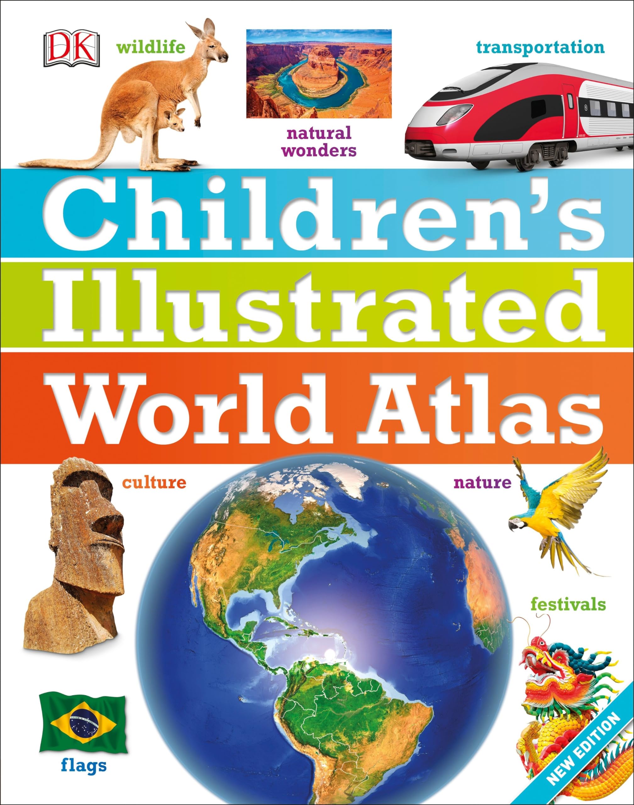
From Bolivia'S Bustling Markets To The Massive And Scorching Sahara Desert, See The World With This Beautifully Illustrated Atlas.Childrens Illustrated World Atlas Is Divided Into Six Main Sections, Each Devoted To A Continent. Within Each Continent, A Country Or A Region Is Explored In Detail Through Stunning Maps Showcasing Cities, Towns, Rivers, Mountain Ranges, And Other Geographical Features.Apart From The Geography Of A Region, Childrens Illustrated World Atlas Also Provides Interesting Information About The People, Their Traditions, Politics, And Economics Through Spectacular Images And Snippets Of Facts.Take A Trip Around The World With Childrens Illustrated World Atlas, From The Majestic Himalayas To The Carnival Of Venice. This Colorful And Comprehensive Book Is The Perfect Addition To Every Book Shelf At Home Or School.
⚠️ WARNING (California Proposition 65):
This product may contain chemicals known to the State of California to cause cancer, birth defects, or other reproductive harm.
For more information, please visit www.P65Warnings.ca.gov.
- Q: What are the dimensions of the Children's Illustrated World Atlas? A: The dimensions are eight point eight two inches in length, zero point six one inches in width, and eleven point one four inches in height.
- Q: How many pages does the Children's Illustrated World Atlas have? A: The atlas contains one hundred forty-four pages, providing a comprehensive overview of world geography.
- Q: What type of binding does the Children's Illustrated World Atlas have? A: The atlas features a hardcover binding, ensuring durability for frequent use by children.
- Q: Is this atlas suitable for children of all ages? A: Yes, the Children's Illustrated World Atlas is designed for children and is suitable for various age groups, particularly for those who are curious about geography.
- Q: How can children use the Children's Illustrated World Atlas? A: Children can explore different continents, countries, and regions through engaging maps and illustrations, making it a fun educational tool.
- Q: Is the Children's Illustrated World Atlas educational? A: Yes, it provides interesting facts about geography, cultures, and traditions, making learning enjoyable for children.
- Q: How should I care for the Children's Illustrated World Atlas? A: To keep it in good condition, store the atlas in a dry place and avoid exposing it to direct sunlight to prevent fading.
- Q: Can the Children's Illustrated World Atlas withstand frequent handling by kids? A: Yes, the hardcover design makes it robust enough to withstand frequent handling and use by children.
- Q: What is the best way to clean the Children's Illustrated World Atlas? A: To clean the atlas, gently wipe the cover and pages with a soft, dry cloth to remove dust without damaging the illustrations.
- Q: Is this atlas a good gift for young readers? A: Yes, the Children's Illustrated World Atlas makes an excellent gift for young readers interested in exploring the world.
- Q: How does this atlas compare to other children's atlases? A: The Children's Illustrated World Atlas is uniquely illustrated and provides extensive information compared to many other children's atlases.
- Q: Is the Children's Illustrated World Atlas suitable for school projects? A: Yes, it is an excellent resource for school projects, offering detailed maps and geographic information.
- Q: What age group is the Children's Illustrated World Atlas best suited for? A: It is best suited for children ages six to twelve, fostering their interest in geography.
- Q: What if the Children's Illustrated World Atlas arrives damaged? A: If the atlas arrives damaged, contact the seller for a return or exchange according to their return policy.
- Q: Are there any other similar products to the Children's Illustrated World Atlas? A: Yes, there are other children's atlases available, but this one is noted for its vibrant illustrations and educational content.
- Q: Can I find information about specific countries in the Children's Illustrated World Atlas? A: Yes, the atlas includes detailed information about various countries and regions around the world.