
Title
Collins Ireland Comprehensive Road Atlas,Used
Sold by Ergodebooks, an authorized reseller.
Returns accepted within 30 days | support@ergodebooks.com
Shipping Information
- Free Standard Shipping — United States only
- Processing Time: 3–5 business days
- Estimated Delivery: 6–10 business days after dispatch
- Double-boxed, fully insured & discreetly packaged
- Tracking number sent via email once dispatched
Returns & Refund
Returns accepted within 30 days of delivery.
Damaged or Defective Item
Free return shipping + replacement or full refund
Wrong Item Received
Free return shipping + replacement or full refund
Change of Mind
Return shipping at customer's expense · 25% restocking fee applies
Payment Option

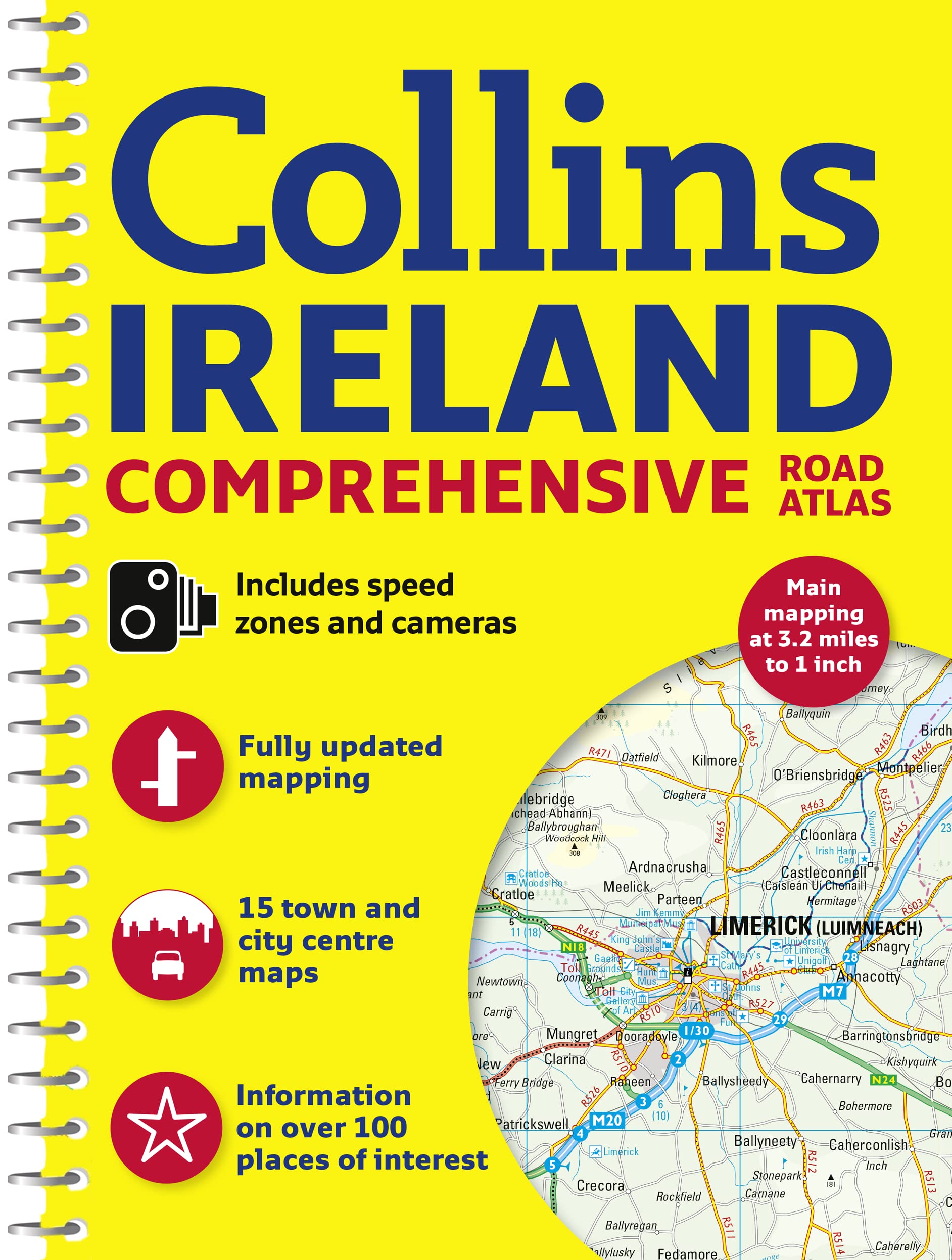
A general purpose map for those who want a high level of mapping detail at a variety of scales, covering the whole of the Republic of Ireland plus Northern Ireland Clear, detailed road mapping of Ireland is presented in this road atlas featuring attractive layer coloring to show land height. The atlas contains a range of mapping scales, including a 9 miles to 1 inch routeplanning map, main maps at 3.2 miles to 1 inch which are ideal for navigation, plus a wide selection of detailed towncenter street plans. It includes the location of safety cameras and also speed enforcement zones, which highlight roads that have a high risk of accidents as identified by the Garda and the National Roads Authority. It also features Blue Flag and Green Coast beaches, which have been evaluated for their water quality and safety, and, in the case of Blue Flag beaches, for such amenities as lifeguards and toilets. The wide range of fully indexed town and citycenter maps cover Bangor, Belfast, Cork, Drogheda, Dublin, Dun Laoghaire, Galway, Kilkenny, Killarney, Limerick, Lisburn, Londonderry (Derry), Newry, Newtownabbey, and Waterford. There is also comprehensive guide information for visitors to Belfast, Cork, Dublin, and Limerick.
⚠️ WARNING (California Proposition 65):
This product may contain chemicals known to the State of California to cause cancer, birth defects, or other reproductive harm.
For more information, please visit www.P65Warnings.ca.gov.