
Title

Cozumel Dive & Adventure Guide Franko Maps Waterproof Map,Used
Sold by Ergodebooks, an authorized reseller.
Returns accepted within 30 days | support@ergodebooks.com
Shipping Information
- Free Standard Shipping — United States only
- Processing Time: 3–5 business days
- Estimated Delivery: 6–10 business days after dispatch
- Double-boxed, fully insured & discreetly packaged
- Tracking number sent via email once dispatched
Returns & Refund
Returns accepted within 30 days of delivery.
Damaged or Defective Item
Free return shipping + replacement or full refund
Wrong Item Received
Free return shipping + replacement or full refund
Change of Mind
Return shipping at customer's expense · 25% restocking fee applies
Payment Option

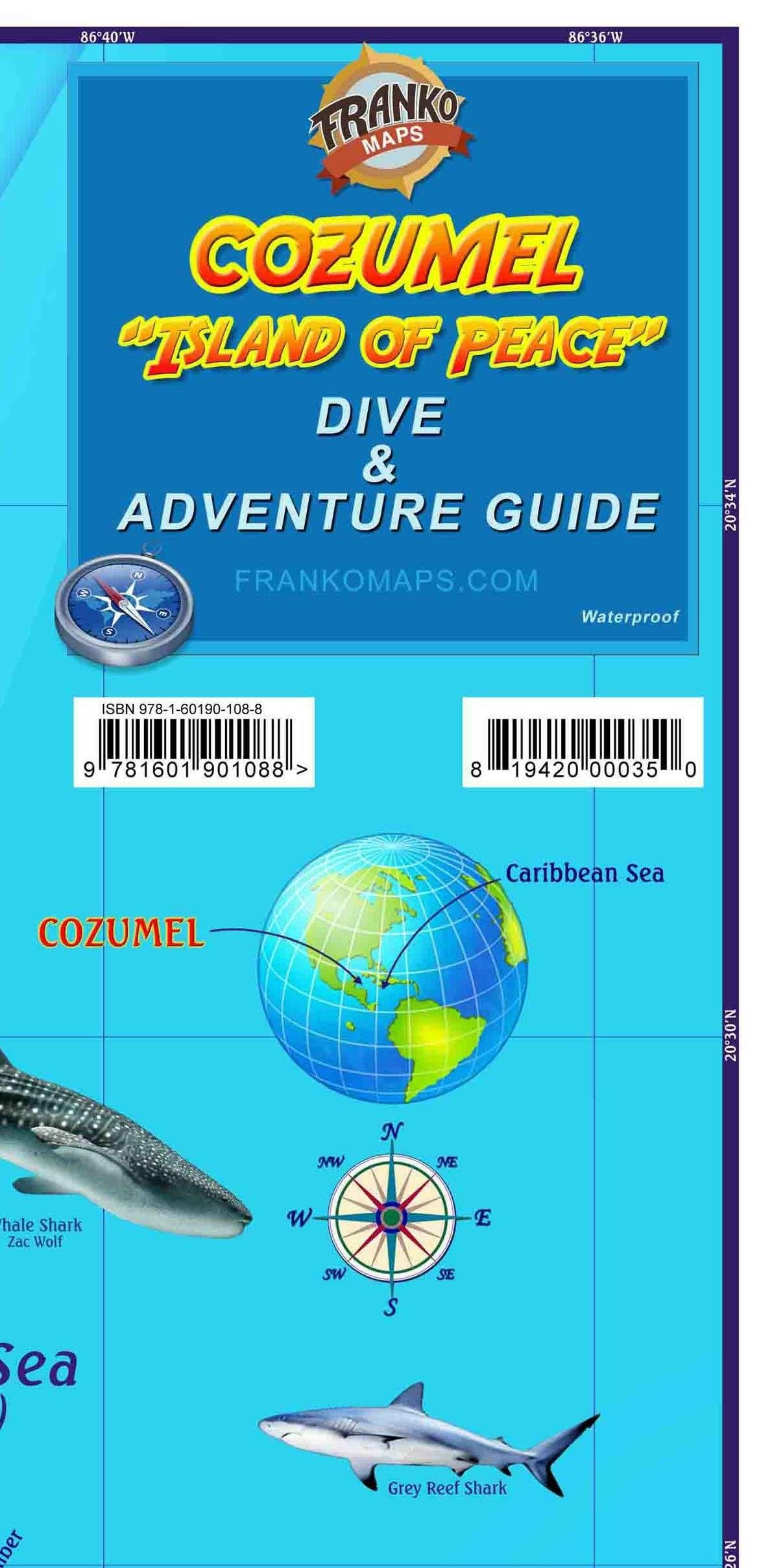
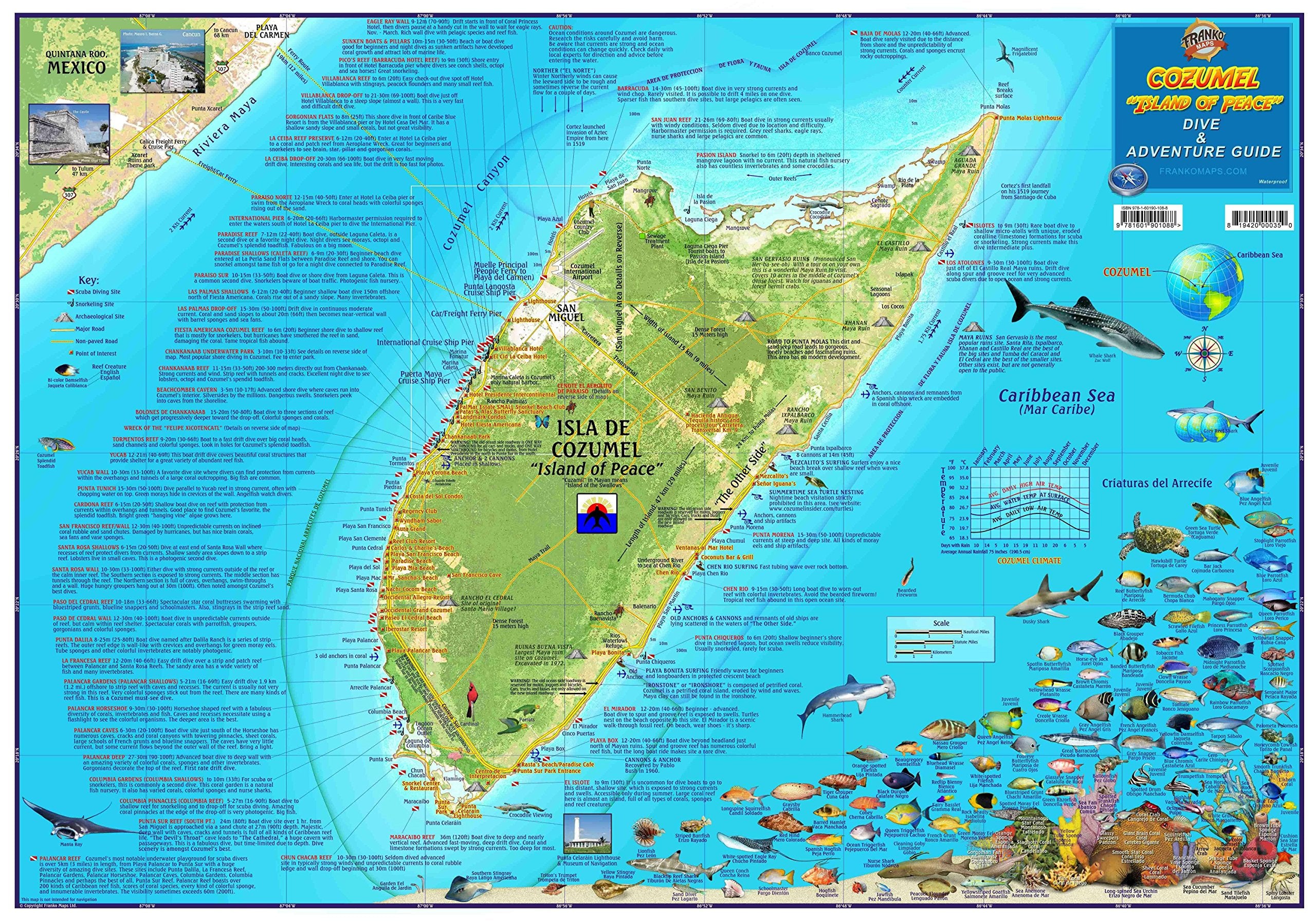
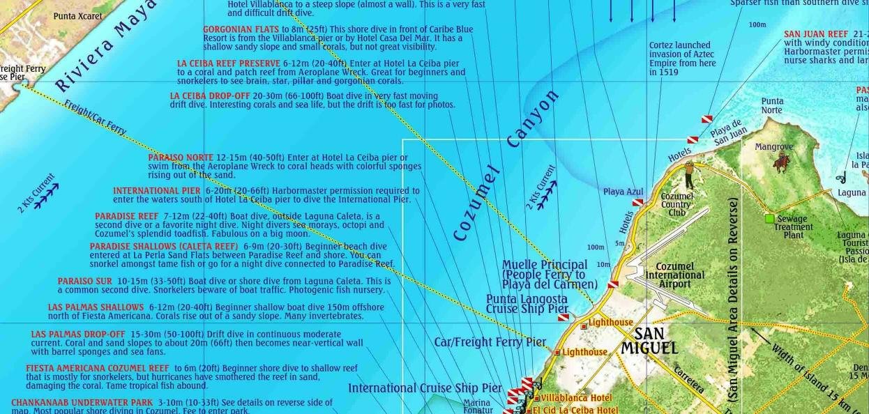
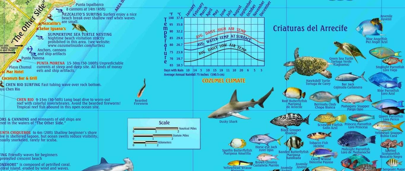
Waterproof recreational map for scuba divers, snorkelers, explorers, tourists. Locations and detailed descriptions of dive sites. Illustrations and common names (in English and Spanish) of 100+ coral reef creatures. Snorkeling sites, archaeological sites, major roads, unpaved roads, places of interest. Chart of average air and surface water temperatures by month. On reverse: maps of Greater and Downtown San Miguel and a crosssection illustration of Cozumel's reef with reef features described. Inset map of Chankanaab Marine National Park. Color photographs. Chart of emergency services with phone numbers for divers. Icons locate dive sites, dive shops, snorkel sites, hotels/resorts. 18.5'x 26', folded to 4.5' x 9' and printed on waterproof, ripresistant synthetic stock.More info: The Franko Map of Cozumel, which is an island just off the Yucatan Peninsula in the state of Quintana Roo, Mexico, features a layout of Isla de Cozumel based on nautical charts and aerial photos. Cozumel's roads, Maya ruins, resorts, and other features are shown on side one. Most important is the location and detailed descriptions of scuba diving and snorkeling sites. Cozumel boasts some of the most outstanding scuba diving and snorkeling on earth. Over 100 species of fish, invertebrates, corals and sponges are depicted in full color with names for easy identification. Side 2 features zoomins and a Cozumel Reefs explanation and artwork. The first feature is a map of Greater San Miguel, which covers much of the west coast, from the Cozumel Country Club on the north to Chankanaab Marine National Park on the south. Chankanaab Park is also show in an enlarged detail. A detailed map of Downtown San Miguel is included. The last detail on side two is the Coral Reefs detail. In it the nature of Cozumel's walls (dropoffs), where scuba divers take a fabulous driftdive ride on Cozumel's strong, clear currents, is described in detail. Updated 2015.
⚠️ WARNING (California Proposition 65):
This product may contain chemicals known to the State of California to cause cancer, birth defects, or other reproductive harm.
For more information, please visit www.P65Warnings.ca.gov.