
Title
Family Maps of Baldwin County, Alabama, Deluxe Edition,Used
Sold by Ergodebooks, an authorized reseller.
Returns accepted within 30 days | support@ergodebooks.com
Shipping Information
- Free Standard Shipping — United States only
- Processing Time: 3–5 business days
- Estimated Delivery: 6–10 business days after dispatch
- Double-boxed, fully insured & discreetly packaged
- Tracking number sent via email once dispatched
Returns & Refund
Returns accepted within 30 days of delivery.
Damaged or Defective Item
Free return shipping + replacement or full refund
Wrong Item Received
Free return shipping + replacement or full refund
Change of Mind
Return shipping at customer's expense · 25% restocking fee applies
Payment Option

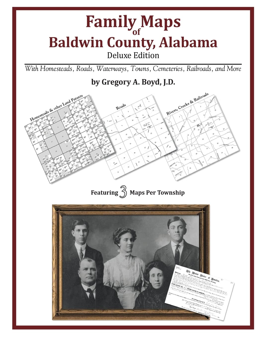
Locating original landowners in maps has never been an easy taskuntil now. This volume in the Family Maps series contains newly created maps of original landowners (patent maps) in what is now Baldwin County, Alabama, gleaned from the indexes of the U.S. Bureau of Land Management. But it offers much more than that. For each township in the county, there are two additional maps accompanying the patent map: a road map and a map showing waterways, railroads, and both modern and many historical citycenters and cemeteries. Included are indexes to help you locate what you are looking for, whether you know a person's name, a last name, a placename, or a cemetery. The combination of maps and indexes are designed to aid researchers of American history or genealogy to explore frontier neighborhoods, examine family migrations, locate hardtofind cemeteries and towns, as well as locate land based on legal descriptions found in old documents or deeds. The patentmaps are essentially plat maps but instead of depicting owners for a particular year, these maps show original landowners, no matter when the transfer from the federal government was completed. Dates of patents typically begin near the time of statehood and run into the early 1900s. 572 pages with 196 total maps What's Mapped in this book (that you'll not likely find elsewhere) . . . 5119 Parcels of Land (with original landowner names and patentdates labeled in the relevant map) 70 Cemeteries plus . . . Roads, and existing Rivers, Creeks, Streams, Railroads, and Smalltowns (including some historical), etc. What YEARS are these maps for? Here are the counts for parcels of land mapped, by the decade in which the corresponding land patents were issued: Decade Parcelcount 1820s 1 1830s 363 1840s 718 1850s 524 1860s 336 1870s 71 1880s 658 1890s 842 1900s 1092 1910s 460 1920s 40 1930s 5 1950s 1 What Cities and Towns are in Baldwin County, Alabama (and in this book)? Barlow Landing, Barnwell, Battles Wharf, Bay Minette, Bayside, Belforest, Blacksher, Blakeley, Bon Secour, Bridgehead, Bromley, Browns Landing, Bryant Landing, Buzbee Landing, Carney, Carpenter, Caswell, Cedar Grove, Clay City, Crossroads, D Olive, Daphne, Darling Landing, D'Olive, Douglasville, Dyas, Eastwood, Elberta, Ellisville, Elsanor, Fairhope, Foley, Foots Landing, Fort McDermott, Fort Morgan, Gasque, Gateswood, Georgetown, Gulf Highlands, Gulf Shores, Holly Hills, Houstonville, Hubbard Landing, Hurricane, Island Landing, Jackson Oak, Josephine, Latham, Lillian, Little River, Live Oak Landing, Lottie, Lower Hall Landing, Loxley, Loyola Villa, Magnolia Beach, Magnolia Springs, Malbis, Marlow, McDonald Lower Landing, Miflin, Military Bridge Landing, Montgomery Hill, Montgomery Hill Landing, Montrose, Mud Landing, Nelson Landing, Oak, Old Island Landing, Orange Beach, Oyster Bay, Palmetto Beach, Park City, Perdido, Perdido Beach, Perkins Landing, Phillipsville, Pinchona, Pine Grove, Pine Haven, Point Clear, Rabun, Redtown, Rice Creek Landing, River Park, Robertsdale, Romar Beach, Rosinton, Seacliff, Seminole, Serange, Shell Landing, Silver Landing, Silverhill, Sizemore Landing, Spanish Fort, Stapleton, Steam Mill Landing, Steelwood, Stockton, Summerdale, Swift, Tensaw, Turkey Branch, Upper Hall Landing, Vangordon, Vaughn, Volanta, Whitehouse Forks, Yelling Settlement, Yupon
⚠️ WARNING (California Proposition 65):
This product may contain chemicals known to the State of California to cause cancer, birth defects, or other reproductive harm.
For more information, please visit www.P65Warnings.ca.gov.