
Title
Family Maps of Jackson County, Alabama, Deluxe Edition,Used
Sold by Ergodebooks, an authorized reseller.
Returns accepted within 30 days | support@ergodebooks.com
Shipping Information
- Free Standard Shipping — United States only
- Processing Time: 3–5 business days
- Estimated Delivery: 6–10 business days after dispatch
- Double-boxed, fully insured & discreetly packaged
- Tracking number sent via email once dispatched
Returns & Refund
Returns accepted within 30 days of delivery.
Damaged or Defective Item
Free return shipping + replacement or full refund
Wrong Item Received
Free return shipping + replacement or full refund
Change of Mind
Return shipping at customer's expense · 25% restocking fee applies
Payment Option

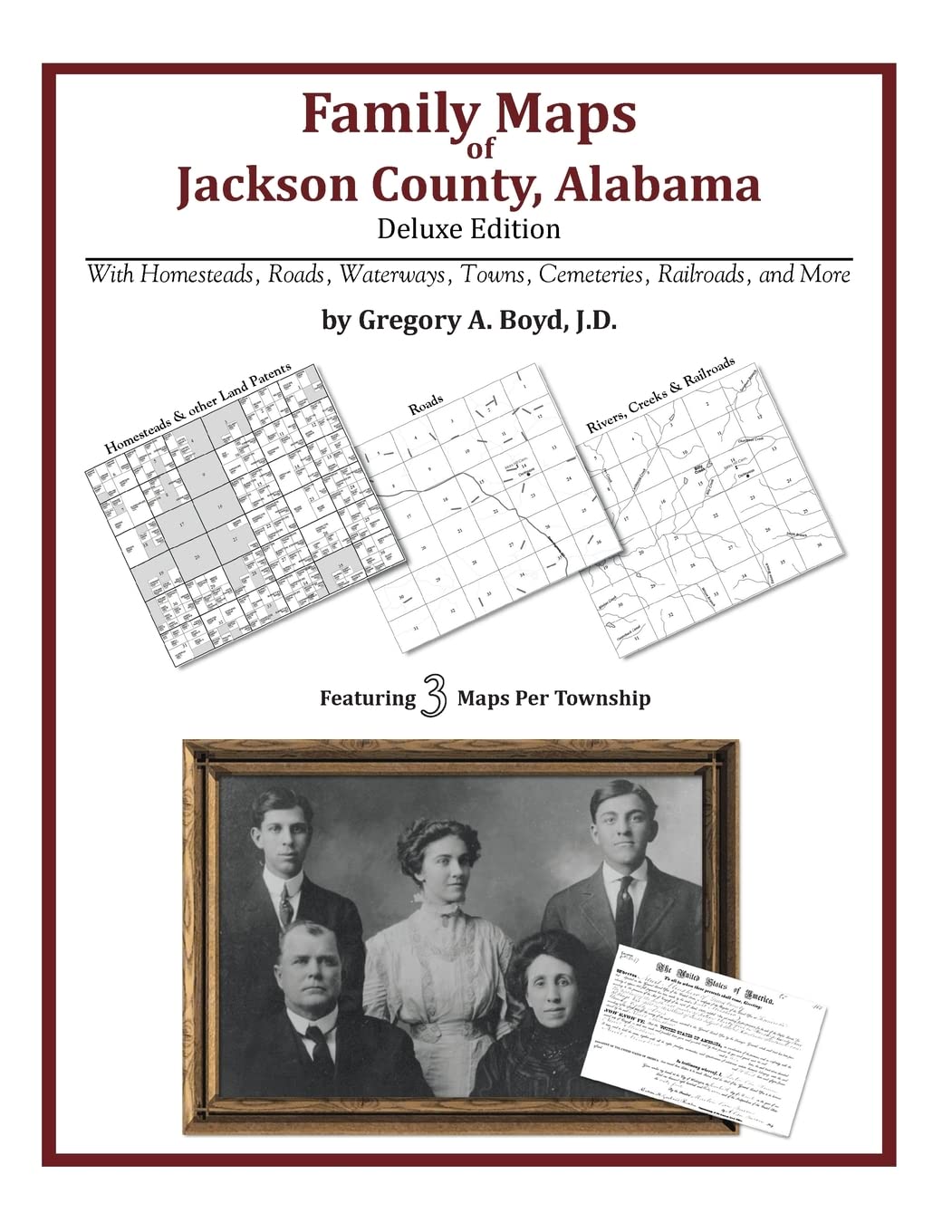
Locating original landowners in maps has never been an easy taskuntil now. This volume in the Family Maps series contains newly created maps of original landowners (patent maps) in what is now Jackson County, Alabama, gleaned from the indexes of the U.S. Bureau of Land Management. But it offers much more than that. For each township in the county, there are two additional maps accompanying the patent map: a road map and a map showing waterways, railroads, and both modern and many historical citycenters and cemeteries. Included are indexes to help you locate what you are looking for, whether you know a person's name, a last name, a placename, or a cemetery. The combination of maps and indexes are designed to aid researchers of American history or genealogy to explore frontier neighborhoods, examine family migrations, locate hardtofind cemeteries and towns, as well as locate land based on legal descriptions found in old documents or deeds. The patentmaps are essentially plat maps but instead of depicting owners for a particular year, these maps show original landowners, no matter when the transfer from the federal government was completed. Dates of patents typically begin near the time of statehood and run into the early 1900s. 504 pages with 122 total maps What's Mapped in this book (that you'll not likely find elsewhere) . . . 9850 Parcels of Land (with original landowner names and patentdates labeled in the relevant map) 237 Cemeteries plus . . . Roads, and existing Rivers, Creeks, Streams, Railroads, and Smalltowns (including some historical), etc. What YEARS are these maps for? Here are the counts for parcels of land mapped, by the decade in which the corresponding land patents were issued: Decade Parcelcount 1820s 2 1830s 2538 1840s 625 1850s 1629 1860s 747 1870s 79 1880s 1022 1890s 2049 1900s 773 1910s 304 1920s 73 What Cities and Towns are in Jackson County, Alabama (and in this book)? Allison, Aspel, Baileytown, Bass, Battery Hill, Bellefonte, Bellview, Blackankle, Bolivar, Bowman Crossroads, Bradford Subdivision (subdivision), Bridgeport, Browntown, Bryant, Cameronsville, Card Switch, Carns, Carver Subdivision (subdivision), Cave Spring, Cedar Grove, Central, Chisenhall Subdivision (subdivision), Coopers Mill, Crossroad, Cumberland Junction, Davistown, Duncan Crossroads, Dutton, Edgefi eld, Eliza, Estillfork, Eureka, Fabius, Fackler, Fair View, Flat Rock, Flippo Ford, Floral Crest, Francisco, Garth, Georgetown, Glenzaida, Gonce, Goodwin Subdivision (subdivision), Hancock Crossroads, Harris, Haynes Crossing, Higdon, Hodge, Hollytree, Hollywood, Hymer (historical), Hytop, Jackson Subdivision (subdivision), Jericho, Kyles, Lake Shore Drive Subdivision, Lakeview Beach (subdivision), Lakeview Shores (subdivision), Langston, Larkin, Larkinsville, Letcher, Lewis Evans Subdivision(subdivision), Liberty Hill, Lim Rock, Little Nashville, Long Island, Macedonia, Martintown, Maynard Cove, McLemore Point Subdivision, Milan (historical), Montague, Morris Mill, Mount Carmel, Nacoochee Point Subdivision, New Hope, New Town, Old Fabius, Overlook, Paint Rock, Pikeville, Pinder Hill, Pisgah, Pleasant Grove, Pleasant Grove, Pleasant Hill, Princeton, Rash, Riverland Estates (subdivision), Rock City, Rocky Springs, Rosalie, Roseberry (subdivision), Sam Gant Subdivision (subdivision), Scottsboro, Section, Shrader, Skyline, Skyline Shores (subdivision), South Sauty Subdivision(subdivision), Stevenson, Sulphur Springs, Summer Bluff, Swaim, Trenton, Tupelo, Wannville, Webb Addition, Wells Ford, Widows Creek Station, Wininger, Woodville, Yucca, Yucca (historical)
⚠️ WARNING (California Proposition 65):
This product may contain chemicals known to the State of California to cause cancer, birth defects, or other reproductive harm.
For more information, please visit www.P65Warnings.ca.gov.