
Title
John Muir Trail MapPack: Shaded Relief Topo Maps (Tom Harrison Maps),New
Sold by Ergodebooks, an authorized reseller.
Returns accepted within 30 days | support@ergodebooks.com
Shipping Information
- Free Standard Shipping — United States only
- Processing Time: 3–5 business days
- Estimated Delivery: 6–10 business days after dispatch
- Double-boxed, fully insured & discreetly packaged
- Tracking number sent via email once dispatched
Returns & Refund
Returns accepted within 30 days of delivery.
Damaged or Defective Item
Free return shipping + replacement or full refund
Wrong Item Received
Free return shipping + replacement or full refund
Change of Mind
Return shipping at customer's expense · 25% restocking fee applies
Payment Option

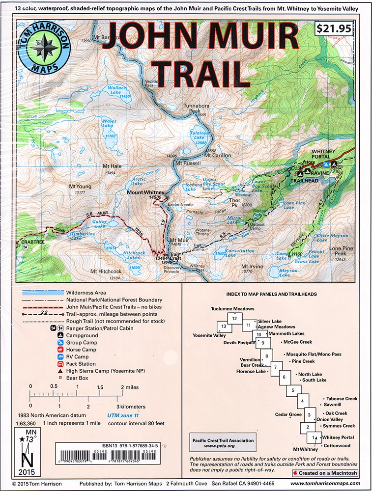
Shaded Relief Topo Maps packet of the famous Sierra High Route that will take hikers from Mount Whitney to Yosemite, CA. Well marked trails over USGS topo maps that were beautifully enhanced with shaded relief to better distinguish details. Scale 1:630360. 1 inch on map equals 1 mile. Whitney Portal, Symmes Creek, Onion Valley, Oak Creek, Taboose Creek, North and South Lakes, Vermilion, Bear Creek, Florence Lake, Pine Creek, Mono Pass, McGee Creek, Devils Postpile, Mammoth Lakes, Agnew Meadows, Silver Lake, Tuolomne Meadows, and finally the Yosemite Valley. GPS Compatible! Complete UTM Grid.
⚠️ WARNING (California Proposition 65):
This product may contain chemicals known to the State of California to cause cancer, birth defects, or other reproductive harm.
For more information, please visit www.P65Warnings.ca.gov.
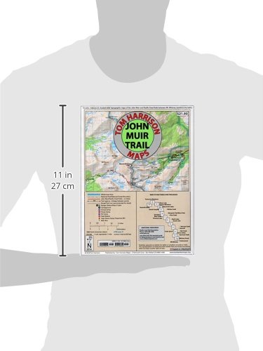
- Q: What are the dimensions of the John Muir Trail Map-Pack? A: The John Muir Trail Map-Pack measures eight point six six inches in length, zero point one two inches in width, and eleven point two two inches in height.
- Q: How many pages does the John Muir Trail Map-Pack contain? A: The map-pack contains thirteen pages. These pages feature detailed shaded relief topo maps for hiking.
- Q: What type of binding does this map-pack have? A: The John Muir Trail Map-Pack is bound as a map. This makes it easy to handle and navigate while hiking.
- Q: How do I use the John Muir Trail Map-Pack? A: To use the map-pack, unfold the maps and follow the marked trails. Each inch on the map represents one mile.
- Q: Is this map suitable for beginners? A: Yes, this map is suitable for beginners. It features well-marked trails that are easy to follow.
- Q: Can I use this map for GPS navigation? A: Yes, the John Muir Trail Map-Pack is GPS compatible. It includes a complete UTM Grid for enhanced navigation.
- Q: How do I keep the John Muir Trail Map-Pack in good condition? A: To maintain the map-pack, store it in a dry place and avoid folding it excessively. This will prevent damage and wear.
- Q: Is the John Muir Trail Map-Pack waterproof? A: No, the map-pack is not waterproof. It is advisable to keep it in a protective case while hiking.
- Q: Can I return the John Muir Trail Map-Pack if I'm not satisfied? A: Yes, you can return the map-pack if you're not satisfied. Be sure to check the return policy for specific details.
- Q: What if the map arrives damaged? A: If the map-pack arrives damaged, you should contact customer support immediately for a replacement or refund.
- Q: What makes this map-pack different from others? A: This map-pack features shaded relief enhancements, making it easier to distinguish trails and terrain details.
- Q: Is this map suitable for GPS devices? A: Yes, it is GPS compatible, allowing for easy integration with GPS devices for navigation.
- Q: Are there specific trails highlighted in this map-pack? A: Yes, the map-pack highlights trails from Mount Whitney to Yosemite, featuring popular routes and landmarks.
- Q: Is the map easy to read in low light conditions? A: Yes, the shaded relief enhances visibility, making it easier to read even in lower light conditions.
- Q: Can I use this map for mountain biking? A: While primarily designed for hiking, some trails may be suitable for mountain biking. Check local regulations.
- Q: Does the map pack include information about camping sites? A: Yes, the map-pack includes information about various camping sites along the John Muir Trail.