
Title

Medieval Maps of the Holy Land,Used
Sold by Ergodebooks, an authorized reseller.
Returns accepted within 30 days | support@ergodebooks.com
Shipping Information
- Free Standard Shipping — United States only
- Processing Time: 3–5 business days
- Estimated Delivery: 6–10 business days after dispatch
- Double-boxed, fully insured & discreetly packaged
- Tracking number sent via email once dispatched
Returns & Refund
Returns accepted within 30 days of delivery.
Damaged or Defective Item
Free return shipping + replacement or full refund
Wrong Item Received
Free return shipping + replacement or full refund
Change of Mind
Return shipping at customer's expense · 25% restocking fee applies
Payment Option

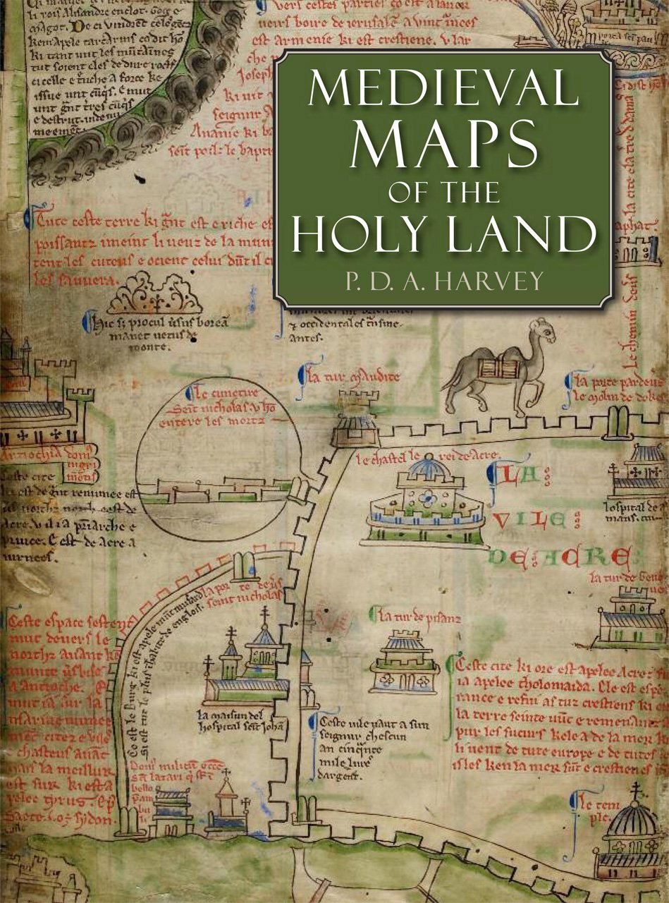
This study examines the eight known medieval regional maps of the Holy Land. Interesting, picturesque, and often colorful, these maps provide great insight into how the Holy Land was perceived by Western Europe in the age of the Crusades. Many of the surviving copies and fragments from the period are reproduced here for the first time, including three large maps that are among medieval Europes finest cartographic monuments.In the course of this study P. D. A. Harvey, a leading historian of medieval maps, undertook detailed detective work that revealed many new discoveries, such as two maps hidden behind newer renditions, a map that was transformed into an erotic fantasy by a nineteenthcentury forger, and information about the origin of a mysterious grid pattern on some of the maps. The research and illustrations presented in Medieval Maps of the Holy Land constitute an important contribution to the studies of medieval culture, early mapping, and crusading Europe.
⚠️ WARNING (California Proposition 65):
This product may contain chemicals known to the State of California to cause cancer, birth defects, or other reproductive harm.
For more information, please visit www.P65Warnings.ca.gov.