
Title
Benchmark Maps Montana Road & Recreation Atlas - Comprehensive Travel Guide for Outdoor Adventures
Sold by Ergodebooks, an authorized reseller.
Returns accepted within 30 days | support@ergodebooks.com
Shipping Information
- Free Standard Shipping — United States only
- Processing Time: 3–5 business days
- Estimated Delivery: 6–10 business days after dispatch
- Double-boxed, fully insured & discreetly packaged
- Tracking number sent via email once dispatched
Returns & Refund
Returns accepted within 30 days of delivery.
Damaged or Defective Item
Free return shipping + replacement or full refund
Wrong Item Received
Free return shipping + replacement or full refund
Change of Mind
Return shipping at customer's expense · 25% restocking fee applies
Payment Option

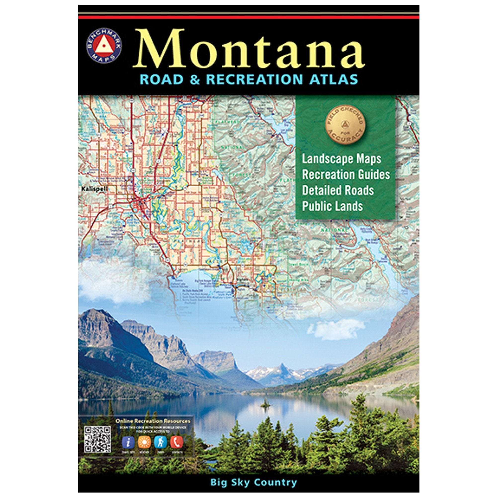
The Montana Road & Recreation Atlas is an essential guide for outdoor enthusiasts and travelers exploring the breathtaking landscapes of Big Sky Country. This comprehensive atlas offers detailed maps and insights into Montana's diverse terrain, making it the perfect companion for both casual adventurers and serious explorers.
This updated 3rd edition is designed to provide an unparalleled mapping experience. Featuring large-scale Landscape Maps™, it showcases Montana's rugged peaks, majestic rivers, and expansive plains with remarkable clarity and detail. The atlas includes a 15-page Recreation Guide that highlights public land details and a wide variety of outdoor activities, ensuring you have everything you need for your Montana adventure.
Key Features:- NEW Base Maps: Enhanced land cover (vegetation) information for better navigation.
- State/BLM Map Detail: Includes boundaries for USFS private inholdings to aid in land navigation.
- Extensive Road Detail: Every road is field-checked for accuracy, ensuring reliable travel routes.
- Recreation Maps: Scale of 1:800,000 (1" = 12.6 miles), ideal for long-distance travel planning.
- Landscape Maps: Scale of 1:250,000 (1" = 4 miles), perfect for detailed exploration of specific areas.
- Comprehensive Coverage: Captures all major recreation landmarks, including trails, lakes, and parks.
- Expert Insights: Created by Benchmark field-checkers who drove thousands of miles to ensure accuracy.
The Montana Road & Recreation Atlas is suitable for hikers, campers, and anyone eager to explore Montana's natural beauty. With its precise mapping and extensive coverage of recreational activities, this atlas serves as an invaluable resource for planning your next outdoor excursion. Whether you're navigating mountain trails or scenic byways, this atlas ensures a reliable and informative experience, making it a must-have for any Montana adventure.
⚠️ WARNING (California Proposition 65):
This product may contain chemicals known to the State of California to cause cancer, birth defects, or other reproductive harm.
For more information, please visit www.P65Warnings.ca.gov.
- Q: What are the dimensions of the Montana Road & Recreation Atlas? A: The dimensions are ten point seventy-five inches in length, zero point fifty-one inches in width, and fifteen point fifty-one inches in height.
- Q: How many pages does the Montana Road & Recreation Atlas have? A: The atlas contains one hundred twenty-eight pages, providing detailed maps and information for exploration.
- Q: What type of binding does this atlas use? A: The Montana Road & Recreation Atlas features a paperback binding, making it lightweight and portable.
- Q: What is included in the Recreation Guide? A: The Recreation Guide includes regional maps with public land details and lists a wide range of outdoor activities for planning.
- Q: How can I use the Montana Road & Recreation Atlas for my travels? A: You can use the atlas to plan outdoor activities, navigate roads, and find recreation landmarks across Montana.
- Q: Is this atlas suitable for someone new to outdoor activities? A: Yes, the atlas provides detailed maps and guides that are ideal for both beginners and experienced adventurers.
- Q: What type of outdoor activities can I find information about in this atlas? A: The atlas lists various outdoor activities, including hiking, fishing, camping, and other recreational pursuits in Montana.
- Q: Can I rely on this atlas for accurate navigation? A: Yes, the atlas has been field-checked for accuracy, ensuring reliable navigation throughout Montana's landscapes.
- Q: How should I care for the Montana Road & Recreation Atlas? A: To keep the atlas in good condition, store it in a dry place and avoid exposing it to extreme temperatures or moisture.
- Q: Is the Montana Road & Recreation Atlas waterproof? A: No, the atlas is not waterproof, so it's best to keep it dry to avoid damage.
- Q: What should I do if my atlas arrives damaged? A: If your atlas arrives damaged, contact the seller for a return or exchange within their specified return policy.
- Q: Can I return the Montana Road & Recreation Atlas if I don't like it? A: Yes, you can typically return the atlas as long as it is within the return window set by the retailer.
- Q: Is this atlas suitable for children? A: Yes, the atlas is suitable for children, especially those interested in outdoor exploration and geography.
- Q: How detailed are the maps in the Montana Road & Recreation Atlas? A: The maps provide extensive detail, including roads, waterways, and recreation landmarks, ensuring thorough navigation.
- Q: What makes the Montana Road & Recreation Atlas different from other maps? A: This atlas features large-scale Landscape Maps and a comprehensive Recreation Guide, offering unmatched detail for outdoor enthusiasts.
- Q: Is this atlas updated with the latest information? A: Yes, the third edition of the atlas includes new base maps and updated details, making it the most accurate resource for Montana.