
Title

National Geographic Canada Wall Map - Executive 38 x 32 in - Multi-Color Reference Map
Sold by Ergodebooks, an authorized reseller.
Returns accepted within 30 days | support@ergodebooks.com
Shipping Information
- Free Standard Shipping — United States only
- Processing Time: 3–5 business days
- Estimated Delivery: 6–10 business days after dispatch
- Double-boxed, fully insured & discreetly packaged
- Tracking number sent via email once dispatched
Returns & Refund
Returns accepted within 30 days of delivery.
Damaged or Defective Item
Free return shipping + replacement or full refund
Wrong Item Received
Free return shipping + replacement or full refund
Change of Mind
Return shipping at customer's expense · 25% restocking fee applies
Payment Option

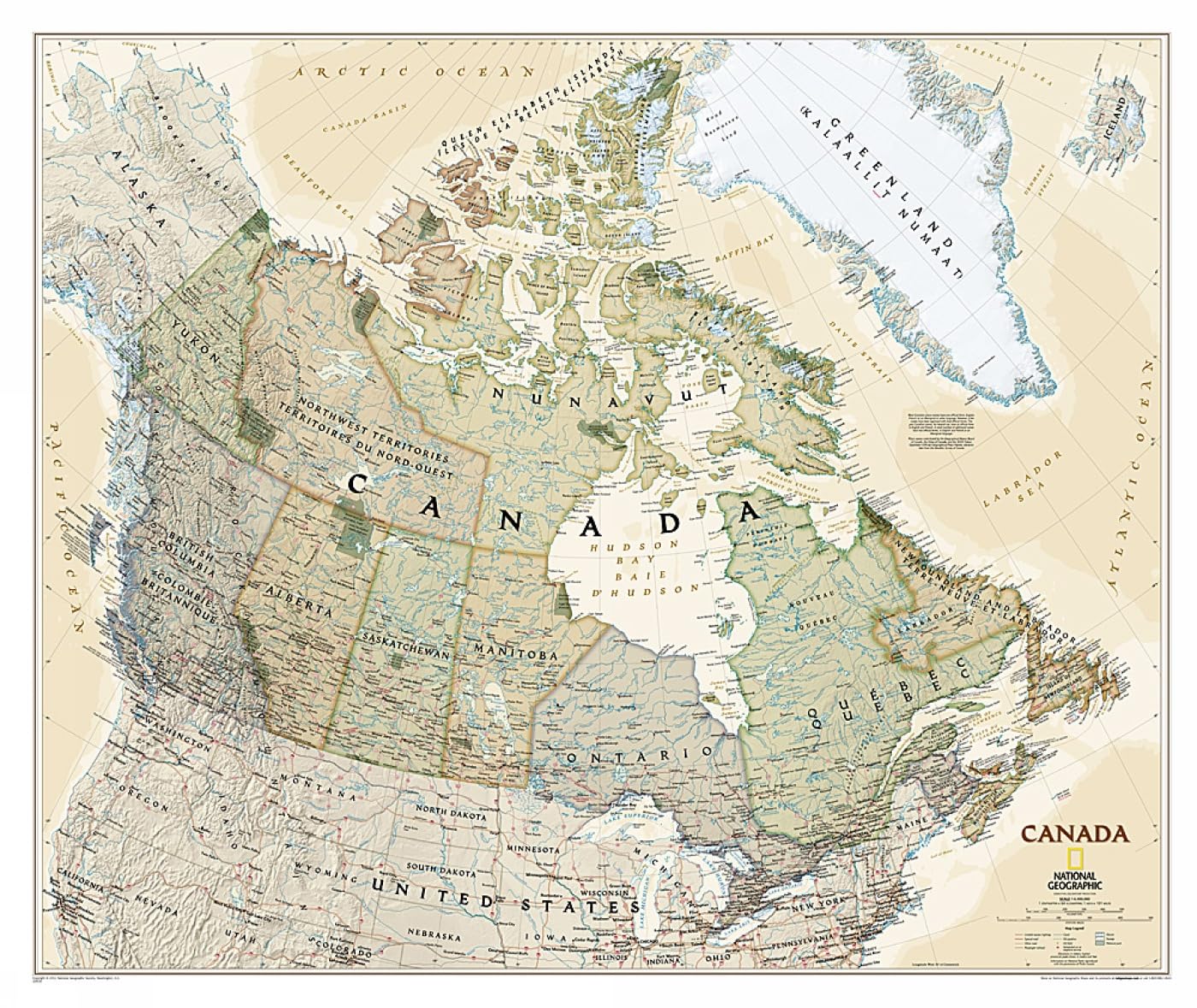
The Executive political map of Canada from National Geographic is a premium cartographic representation designed for educational and decorative purposes. Ideal for classrooms, offices, and personal spaces, this map showcases the intricate geographical and political details of Canada and its northern neighbors.
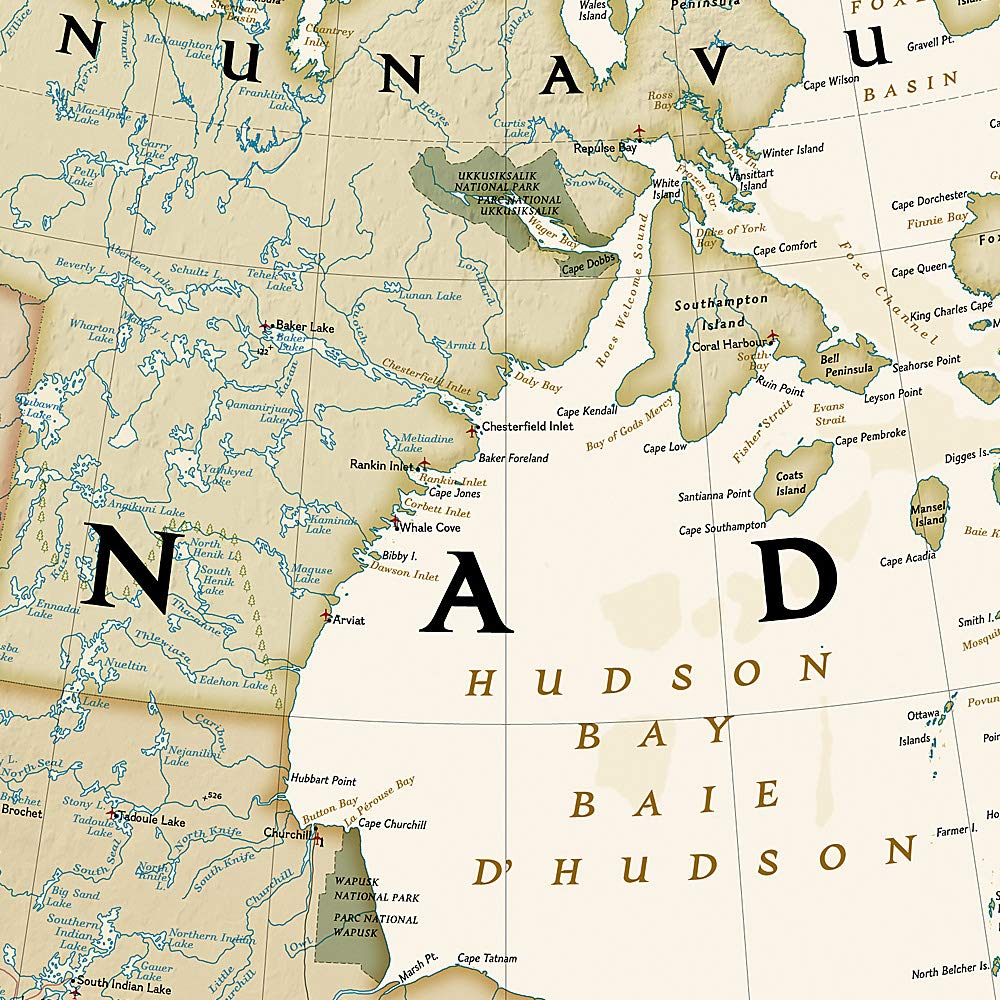
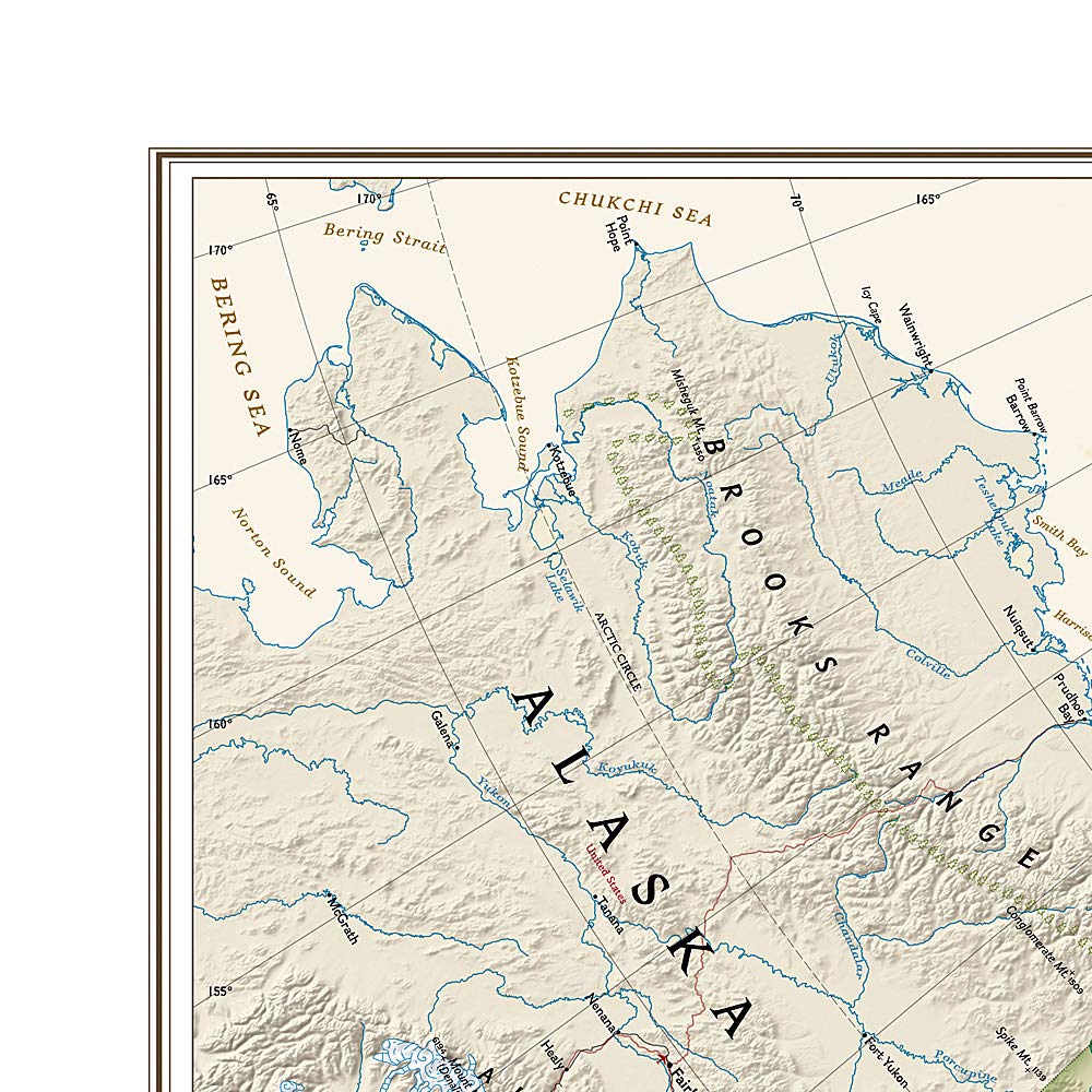
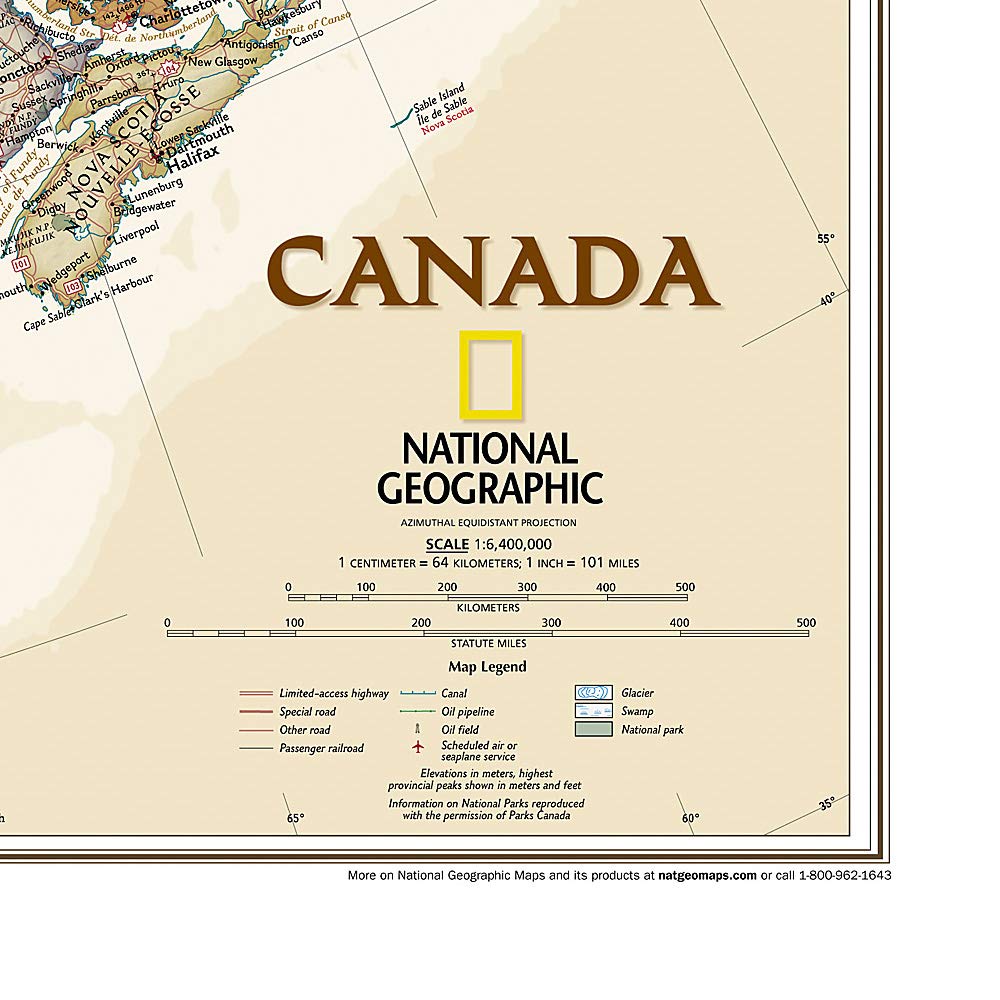
This map features a captivating antique-style color palette that enhances its visual appeal. Notably, it includes shaded relief to give a three-dimensional perspective of the terrain. The map is meticulously detailed, showcasing thousands of place names, accurate political boundaries, and significant landmarks such as national parks, archaeological sites, and major infrastructure networks, including roads, airports, canals, and railroads. This comprehensive coverage extends beyond Canada to include Iceland, Greenland, and parts of the northern United States, making it a valuable resource for anyone interested in the geography of North America.
Key Features:- High-Quality Cartography: Created by National Geographic, ensuring accuracy and detail in geographical representation.
- Antique-Style Color Palette: A visually appealing design that enhances any space, perfect for home or office decor.
- Shaded Relief: Provides a three-dimensional view of the terrain, adding depth and realism to the map.
- Comprehensive Coverage: Includes thousands of place names, political boundaries, national parks, and more across Canada and its northern territories.
- Convenient Packaging: Comes in a sturdy two-inch diameter tube, making it easy to store and transport while protecting the map.
- Large Sheet Size: Measures 38" x 32", making it an impressive centerpiece for any wall.
- Map Scale: 1:6,468,000 scale offers a detailed view of geographical features for educational and reference purposes.
The Executive political map of Canada is an excellent choice for educators, students, travelers, and geography enthusiasts. Its detailed design and informative content make it not only a practical reference tool but also an attractive addition to any room. With its blend of functionality and aesthetic appeal, this map is perfect for those who appreciate the beauty and complexity of Canadian geography.
⚠️ WARNING (California Proposition 65):
This product may contain chemicals known to the State of California to cause cancer, birth defects, or other reproductive harm.
For more information, please visit www.P65Warnings.ca.gov.
- Q: What are the dimensions of the National Geographic Canada Wall Map? A: The map measures thirty-eight inches by thirty-two inches. It's a large, detailed wall map designed for easy viewing.
- Q: What type of binding does this map have? A: This wall map is bound as a map. It comes rolled up in a tube for easy storage and handling.
- Q: What is the scale of the National Geographic Canada Wall Map? A: The scale is one to six million, four hundred sixty-eight thousand. This provides a detailed view of geographical features.
- Q: How should I hang the National Geographic Canada Wall Map? A: You can hang the map using push pins or adhesive strips. Ensure it is mounted on a flat surface for best visibility.
- Q: Is this map suitable for educational purposes? A: Yes, this map is excellent for educational purposes. It displays political boundaries, national parks, and infrastructure, making it informative.
- Q: Can I use this map for outdoor activities? A: Yes, this map is useful for outdoor activities such as hiking and camping. It highlights national parks and major infrastructure.
- Q: How do I keep the National Geographic Canada Wall Map in good condition? A: To maintain the map, avoid exposure to direct sunlight and moisture. Store it in a cool, dry place when not displayed.
- Q: Is this map durable and long-lasting? A: Yes, the National Geographic wall map is designed for durability. It is printed on high-quality paper for long-lasting use.
- Q: How should I clean the National Geographic Canada Wall Map? A: To clean the map, use a soft, dry cloth. Avoid using water or cleaning solutions that could damage the paper.
- Q: Can I return the National Geographic Canada Wall Map if I'm not satisfied? A: Yes, you can return the map if it does not meet your expectations. Check the retailer's return policy for specific details.
- Q: What if the map arrives damaged? A: If the map arrives damaged, contact customer support for assistance. They can help with returns or exchanges.
- Q: Is the National Geographic Canada Wall Map suitable for all ages? A: Yes, this map is suitable for all ages. It is educational and visually appealing, making it great for families.
- Q: Does this map include major cities and landmarks? A: Yes, the map includes thousands of place names, major cities, and landmarks. It's detailed for both geographic learning and planning.
- Q: What additional areas are covered in this map besides Canada? A: In addition to Canada, the map covers Iceland, Greenland, and the northern United States, providing a broader geographical context.
- Q: Who is the publisher of the National Geographic Canada Wall Map? A: The map is published by National Geographic Maps, known for their high-quality cartographic products.
- Q: What material is the National Geographic Canada Wall Map made of? A: The map is printed on high-quality paper. It is designed to be visually engaging and durable for repeated use.