
Title
National Geographic Cuba Wall Map - Classic Poster, 36 x 24 in, Multi Color, Model 749717006607
Sold by Ergodebooks, an authorized reseller.
Returns accepted within 30 days | support@ergodebooks.com
Shipping Information
- Free Standard Shipping — United States only
- Processing Time: 3–5 business days
- Estimated Delivery: 6–10 business days after dispatch
- Double-boxed, fully insured & discreetly packaged
- Tracking number sent via email once dispatched
Returns & Refund
Returns accepted within 30 days of delivery.
Damaged or Defective Item
Free return shipping + replacement or full refund
Wrong Item Received
Free return shipping + replacement or full refund
Change of Mind
Return shipping at customer's expense · 25% restocking fee applies
Payment Option

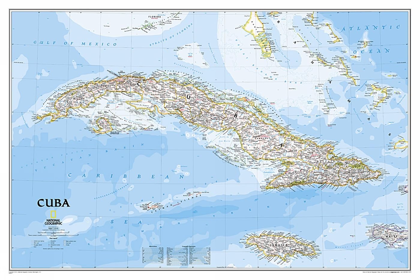
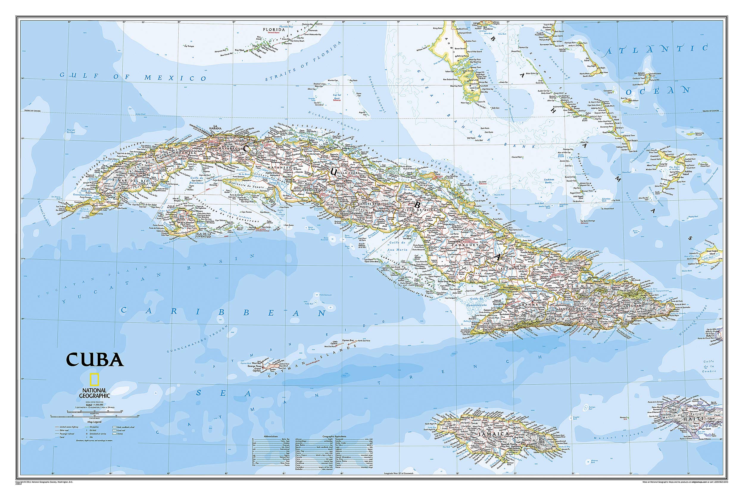
Discover the beauty and intricacies of Cuba with the National Geographic Classic Style Map. This meticulously crafted map is ideal for travelers, educators, and geography enthusiasts seeking to explore the vibrant landscapes and cultural landmarks of Cuba and its surrounding regions.
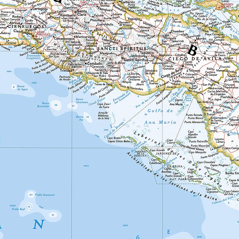
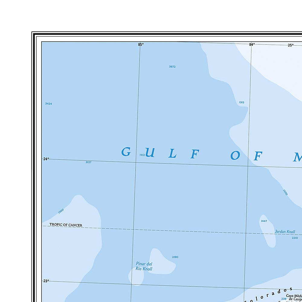
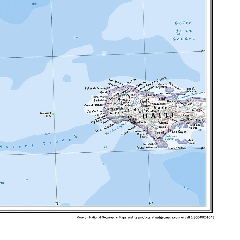
The National Geographic Classic Style Map of Cuba features a bright and vibrant color palette, enhanced by stunning shaded relief and detailed ocean bathymetry. This expertly researched map not only highlights Cuba but also includes thousands of cities, towns, national parks, mountains, swamps, coral reefs, and islands throughout the archipelago. Major infrastructure networks such as highways, roads, railroads, oil fields, pipelines, airports, canals, and ferry routes are displayed for easy navigation. Additionally, neighboring areas including Jamaica, the Cayman Islands, the Florida Keys, and parts of the Bahamas and Haiti are showcased, along with significant bodies of water like the Gulf of Mexico, Caribbean Sea, Atlantic Ocean, and Straits of Florida. A user-friendly index provides English translations for many geographic terms.
Key Features:- Map Scale: 1:1,500,000 for accurate representation of distances.
- Sheet Size: 36" x 24" for detailed viewing and display.
- Bright color palette with shaded relief, enhancing geographic features.
- Includes thousands of identified cities, towns, and natural landmarks.
- Major infrastructure networks displayed for comprehensive navigation.
- Packaged in a durable 2-inch diameter tube for easy storage and transport.
- User-friendly index with English translations for geographic terms.
This National Geographic map is an excellent resource for educators teaching geography, travelers planning their adventures, or anyone with a passion for exploring Cuba's diverse landscapes. Its detailed design and practical features make it a valuable addition to any collection, whether for educational purposes or decorative display. Invest in your exploration of Cuba with this high-quality, visually stunning map that brings the rich culture and geography of the region to life.
⚠️ WARNING (California Proposition 65):
This product may contain chemicals known to the State of California to cause cancer, birth defects, or other reproductive harm.
For more information, please visit www.P65Warnings.ca.gov.
- Q: What are the dimensions of the National Geographic Cuba Wall Map? A: The dimensions are thirty-six inches by twenty-four inches. This makes it a poster-sized map, ideal for displaying.
- Q: What is the scale of the Cuba Wall Map? A: The map scale is one to one million five hundred thousand. It provides a detailed overview of Cuba's geography.
- Q: Who is the author of the Cuba Wall Map? A: The author is National Geographic Maps. They are known for their expert research and design in cartography.
- Q: How do I display the National Geographic Cuba Wall Map? A: You can display it by framing or simply mounting it on a wall. It comes rolled in a tube for easy handling.
- Q: Is the Cuba Wall Map suitable for educational purposes? A: Yes, it is suitable for educational purposes. It highlights major cities, parks, and geographical features, making it great for learning.
- Q: Can I use this map for travel planning? A: Yes, you can use it for travel planning. It shows highways, airports, and attractions across Cuba.
- Q: How should I store the Cuba Wall Map? A: You should store it rolled or flat in a cool, dry place. Avoid exposure to moisture to preserve it.
- Q: Is the National Geographic Cuba Wall Map durable? A: Yes, the map is made with quality materials for durability. It can withstand handling and display without damage.
- Q: What is the packaging of the Cuba Wall Map like? A: It is packaged in a two-inch diameter tube. This protects the map during shipping and storage.
- Q: Is the Cuba Wall Map easy to read? A: Yes, it features a user-friendly index. Geographic terms are translated into English for clarity.
- Q: Can I use the Cuba Wall Map for decoration? A: Yes, it is a great decorative piece. Its vibrant colors and detailed features make it visually appealing.
- Q: What areas are covered in the Cuba Wall Map? A: It covers Cuba and includes parts of Jamaica, the Cayman Islands, and the Florida Keys. Major bodies of water are also shown.
- Q: Is this map suitable for kids? A: Yes, it is suitable for kids. The bright colors and detailed information make it engaging and educational.
- Q: What type of binding does the Cuba Wall Map have? A: The map is bound as a traditional map. It is printed on quality paper for durability and ease of use.
- Q: Does the map include geographical features? A: Yes, it includes mountains, swamps, coral reefs, and islands. These features enhance its educational value.
- Q: What should I do if the map arrives damaged? A: If the map arrives damaged, contact customer support for a replacement. They typically offer a satisfaction guarantee.