
Title
Natl Geographic England and Wales Wall Map - Classic 30 x 36 in, Model 9781787582859
Sold by Ergodebooks, an authorized reseller.
Returns accepted within 30 days | support@ergodebooks.com
Shipping Information
- Free Standard Shipping — United States only
- Processing Time: 3–5 business days
- Estimated Delivery: 6–10 business days after dispatch
- Double-boxed, fully insured & discreetly packaged
- Tracking number sent via email once dispatched
Returns & Refund
Returns accepted within 30 days of delivery.
Damaged or Defective Item
Free return shipping + replacement or full refund
Wrong Item Received
Free return shipping + replacement or full refund
Change of Mind
Return shipping at customer's expense · 25% restocking fee applies
Payment Option

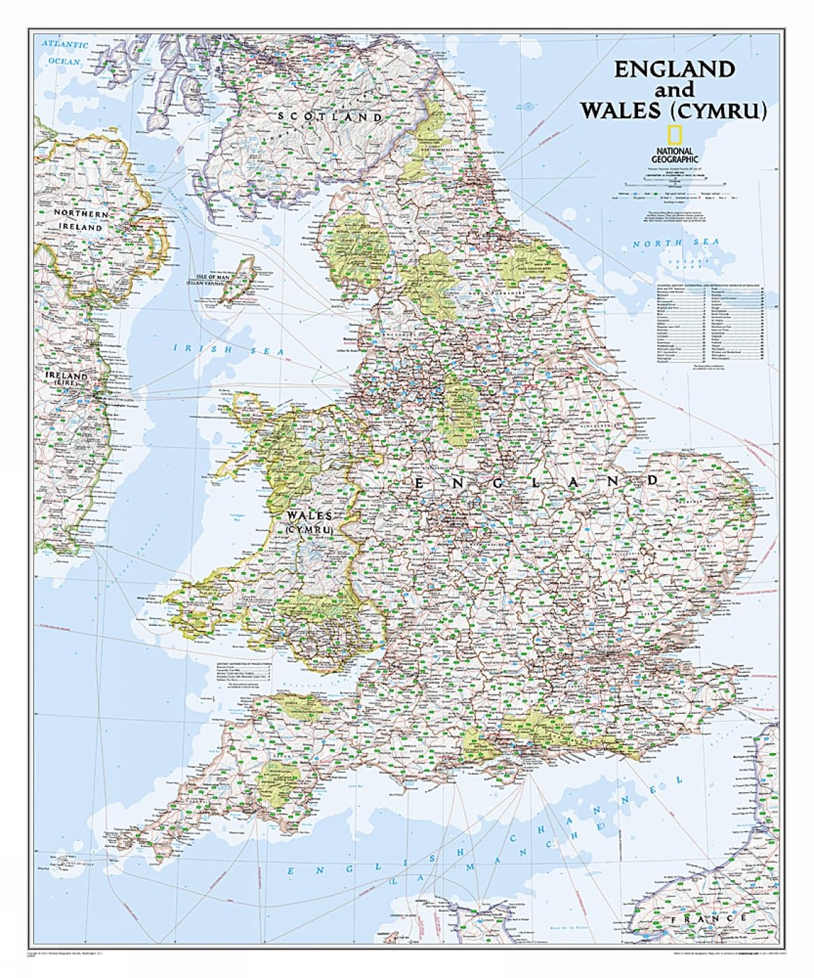
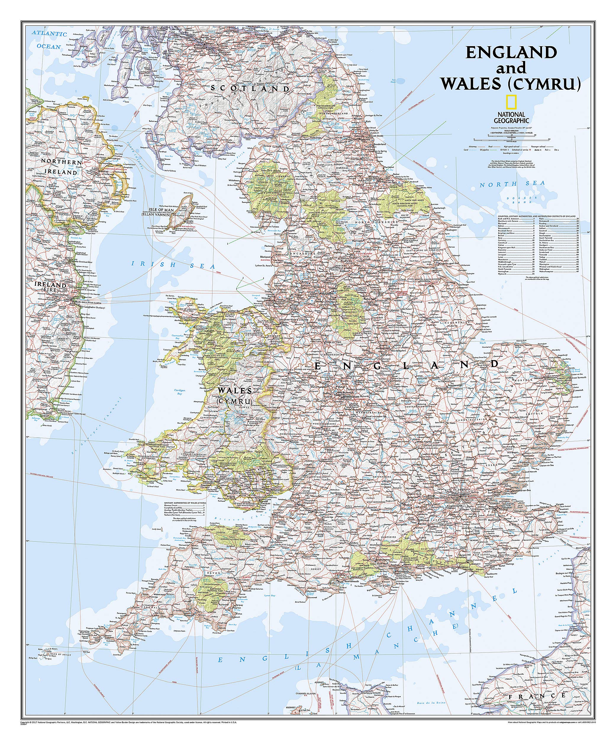
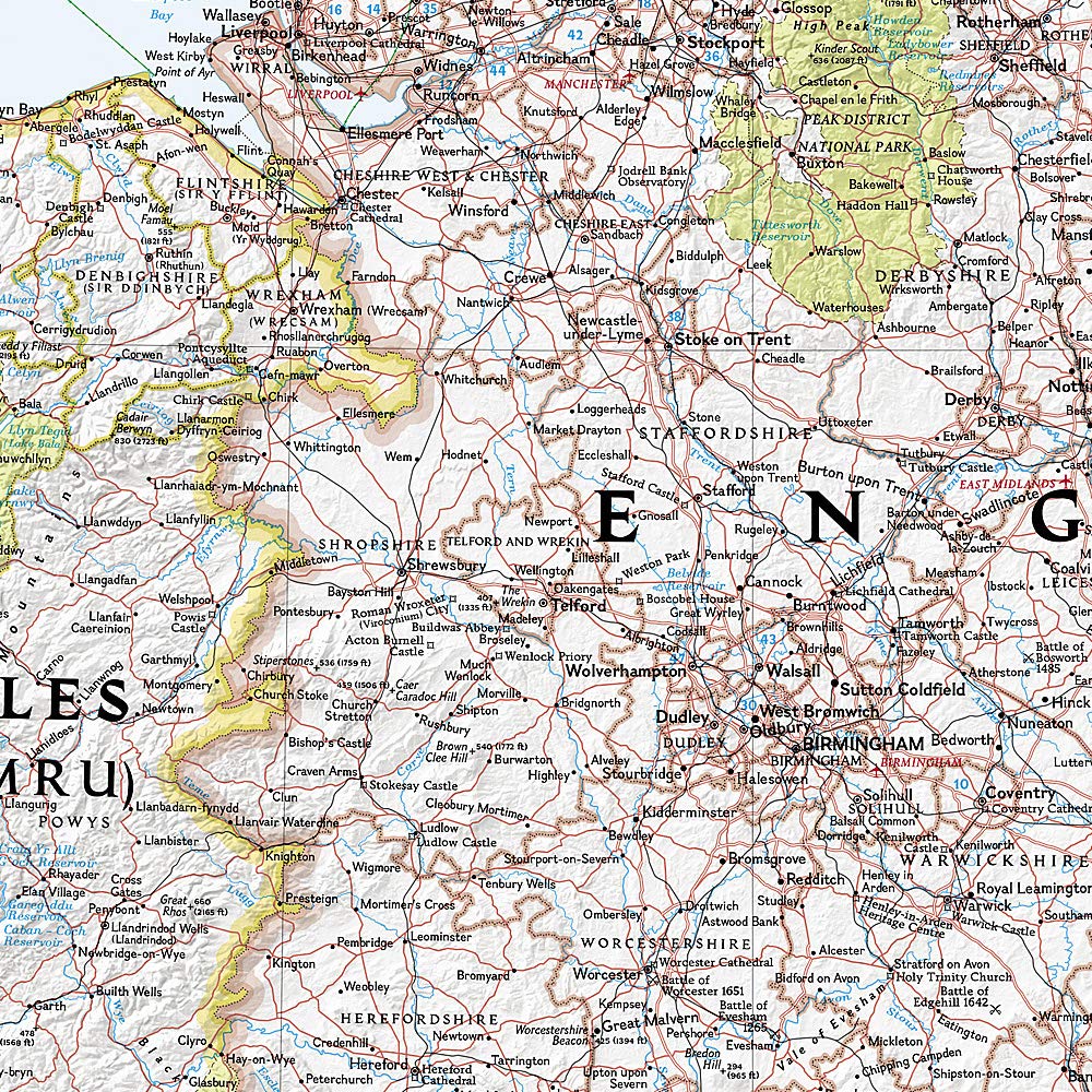
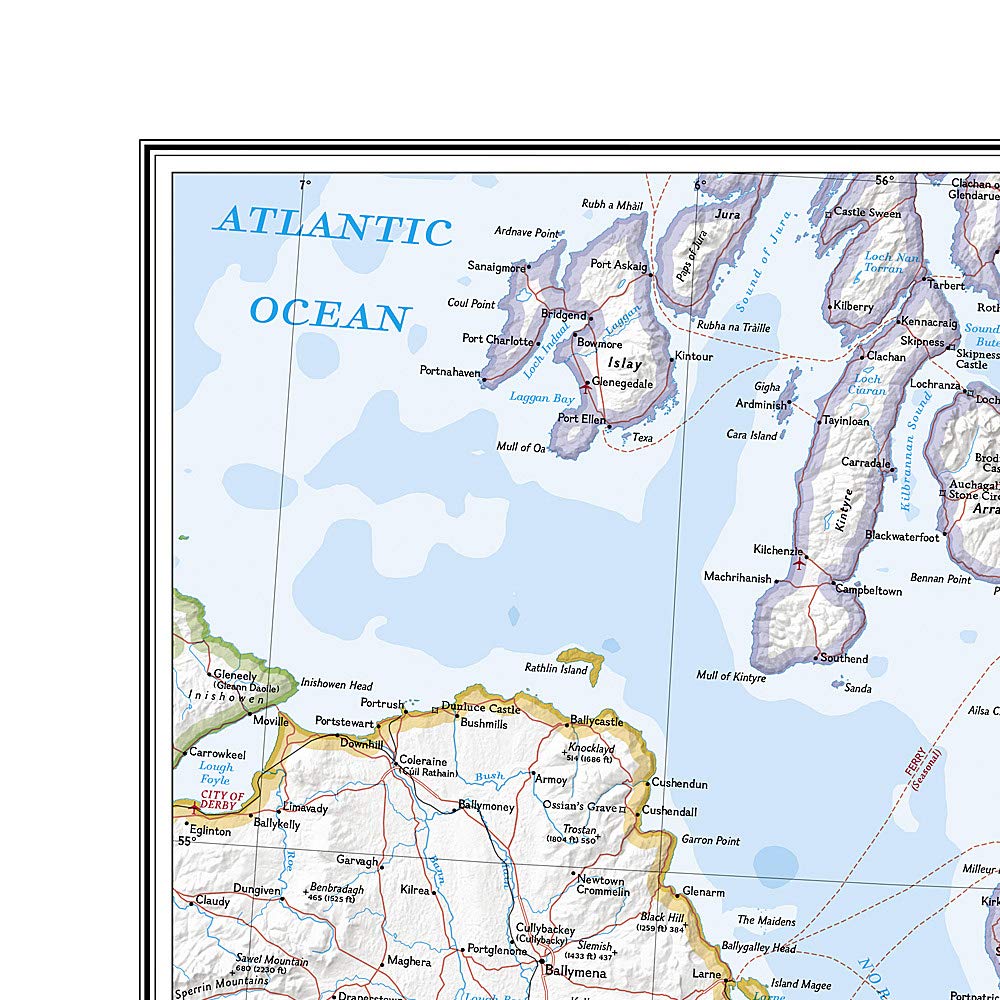
Explore the intricate landscapes of England and Wales with National Geographic's Classic style wall map. This meticulously crafted map serves as both a decorative piece and a functional tool for travelers, educators, and geography enthusiasts. Perfect for homes, classrooms, or offices, it provides an extensive overview of two of Great Britain's most captivating regions.
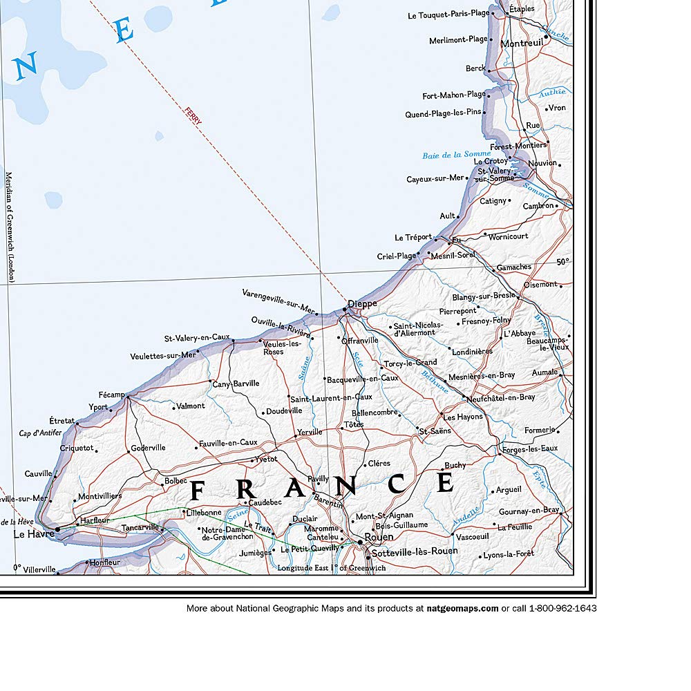
This wall map is expertly researched and designed, showcasing exceptional detail through vibrant colors and stunning shaded relief. For over 75 years, National Geographic has been synonymous with high-quality cartography, and this map is no exception. It features clearly defined administrative divisions and thousands of place names, including cities, historical landmarks, bodies of water, and national parks, making it an invaluable resource for anyone interested in the geography of the area.
Key Features:- Exceptional Detail: Provides an in-depth view of England and Wales, including parts of Scotland, Northern Ireland, Ireland, and France.
- Vibrant Color Palette: Bright colors enhance visibility, with blue oceans and terrain depicted in stunning shaded relief.
- Comprehensive Transportation Infrastructure: Clearly indicated roads, motorways, airports, canals, ferry routes, and railroads facilitate navigation.
- Coastal Bathymetry: Depth curves and soundings illustrate the coastal geography, adding another layer of detail.
- Convenient Packaging: The map arrives rolled in a two-inch diameter tube, making it easy to store and transport.
- Map Scale: 1:868,000, providing a practical scale for both detailed and broader overviews of the regions.
- Sheet Size: 30" x 36", a perfect size for display in homes or offices.
This National Geographic wall map is ideal for educators seeking a visual aid for geography lessons, travelers planning their next adventure, or anyone who appreciates the beauty and complexity of England and Wales. Its high-quality design and comprehensive detail make it a valuable addition to any collection, ensuring you stay informed about the geography of this historic region.
⚠️ WARNING (California Proposition 65):
This product may contain chemicals known to the State of California to cause cancer, birth defects, or other reproductive harm.
For more information, please visit www.P65Warnings.ca.gov.
- Q: What are the dimensions of the National Geographic England and Wales Wall Map? A: The dimensions of the map are thirty inches by thirty-six inches. Its size makes it suitable for wall display in various spaces.
- Q: What is the scale of the National Geographic England and Wales Wall Map? A: The map scale is one to eight hundred sixty-eight thousand. This scale provides detailed geographical features and administrative divisions.
- Q: Is this wall map rolled or flat upon delivery? A: The map is packaged in a tube for safe delivery. This ensures it arrives without creases, ready for display.
- Q: How do I display the National Geographic England and Wales Wall Map? A: You can mount this map on a wall using adhesive strips or a frame. It’s designed for easy installation in homes or offices.
- Q: Is the National Geographic England and Wales Wall Map suitable for educational purposes? A: Yes, it is suitable for educational use. Its detailed features make it a great resource for learning about geography and history.
- Q: Can I use this wall map for travel planning? A: Yes, this map is excellent for travel planning. It highlights roads, airports, and national parks, aiding in route selection.
- Q: How should I clean the National Geographic England and Wales Wall Map? A: To clean the map, use a dry cloth or soft brush. Avoid using water or cleaning solutions to prevent damage.
- Q: What is the best way to store the wall map if not displayed? A: If not displayed, store the map rolled in its tube. This prevents creasing and keeps it in good condition.
- Q: Is the National Geographic England and Wales Wall Map durable? A: Yes, the map is designed for durability. It is printed on high-quality materials that resist wear and fading.
- Q: How can I return the National Geographic England and Wales Wall Map if needed? A: You can return the map within the specified return period. Ensure it is in its original condition and packaging.
- Q: What if my map arrives damaged? A: If your map arrives damaged, contact customer service for a replacement. They will assist you with the return process.
- Q: Are there any additional maps included with the National Geographic England and Wales Wall Map? A: No, the package only includes the National Geographic England and Wales Wall Map. It focuses solely on that region.
- Q: Can I frame the National Geographic England and Wales Wall Map? A: Yes, the map can be framed. It fits standard frame sizes, enhancing its visual appeal when displayed.
- Q: What geographical areas does the map cover beyond England and Wales? A: The map also includes portions of Scotland, Northern Ireland, Ireland, and France. This provides a broader geographical context.
- Q: Is the map suitable for wall decoration in a child's room? A: Yes, the map can be a great educational decoration in a child's room. It introduces geography in a visually appealing way.