
Title
National Geographic: France, Belgium, and The Netherlands Executive Wall Map (23 x 30 inches) (National Geographic Reference Map,Used
Sold by Ergodebooks, an authorized reseller.
Returns accepted within 30 days | support@ergodebooks.com
Shipping Information
- Free Standard Shipping — United States only
- Processing Time: 3–5 business days
- Estimated Delivery: 6–10 business days after dispatch
- Double-boxed, fully insured & discreetly packaged
- Tracking number sent via email once dispatched
Returns & Refund
Returns accepted within 30 days of delivery.
Damaged or Defective Item
Free return shipping + replacement or full refund
Wrong Item Received
Free return shipping + replacement or full refund
Change of Mind
Return shipping at customer's expense · 25% restocking fee applies
Payment Option

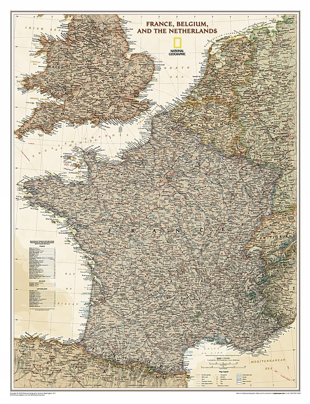
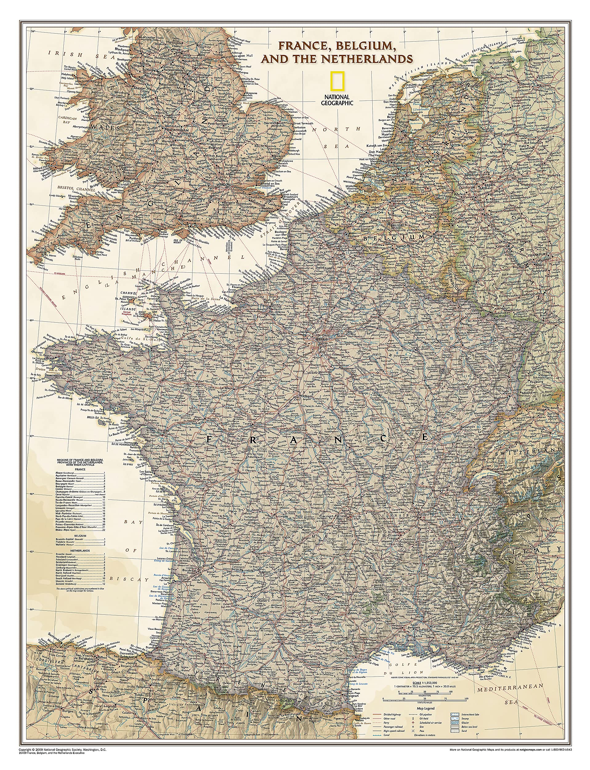
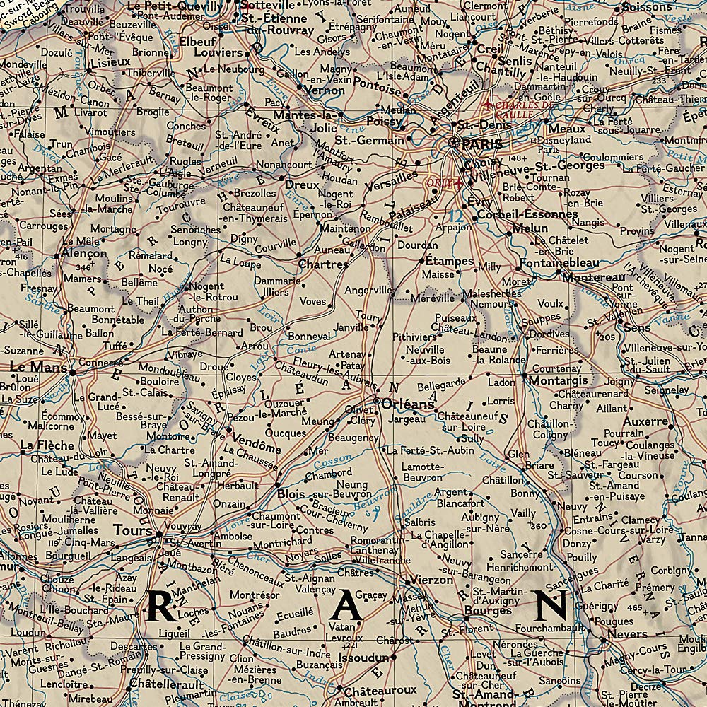
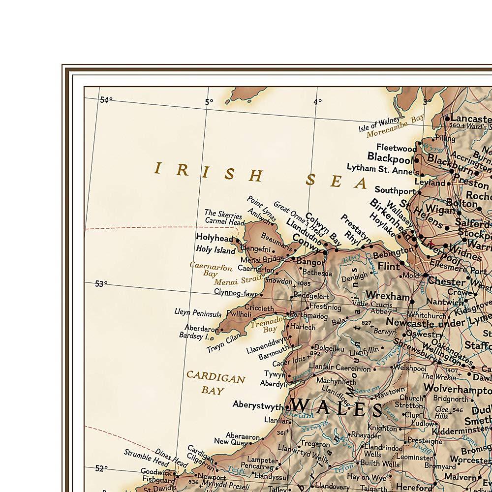
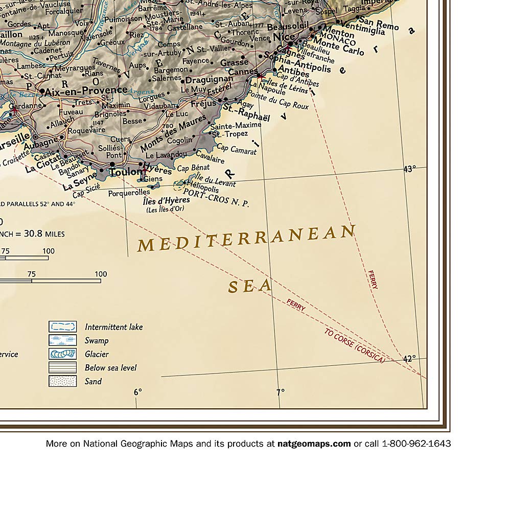
National Geographic's Executive style wall map of France, Belgium and The Netherlands is beautifully rendered with unparalleled detail using an antique inspired color palette. The stunning shaded relief is complemented by clearly defined international boundaries, national subdivisions, thousands of place names, national parks, swamps, glaciers, intermittent lakes, mountain passes, areas of sand and land below sea level. In addition, major infrastructure networks are displayed such as airports, highways and roads, oil fields and pipelines, highspeed railway lines, canals and ferry routes. Luxembourg and portions of the United Kingdom, Germany, Switzerland, Spain, and Italy are shown as well.The map is packaged in a two inch diamater clear plastic tube. The tube has a decorative label showing a thumbnail of the map with dimensions and other pertinent information. Map Scale = 1:1,953,000 Sheet Size = 23" x 30"
⚠️ WARNING (California Proposition 65):
This product may contain chemicals known to the State of California to cause cancer, birth defects, or other reproductive harm.
For more information, please visit www.P65Warnings.ca.gov.