
Title
National Geographic Pacific Centered Wall Map - Classic Laminated (46 x 30.5 in) - Blue
Sold by Ergodebooks, an authorized reseller.
Returns accepted within 30 days | support@ergodebooks.com
Shipping Information
- Free Standard Shipping — United States only
- Processing Time: 3–5 business days
- Estimated Delivery: 6–10 business days after dispatch
- Double-boxed, fully insured & discreetly packaged
- Tracking number sent via email once dispatched
Returns & Refund
Returns accepted within 30 days of delivery.
Damaged or Defective Item
Free return shipping + replacement or full refund
Wrong Item Received
Free return shipping + replacement or full refund
Change of Mind
Return shipping at customer's expense · 25% restocking fee applies
Payment Option

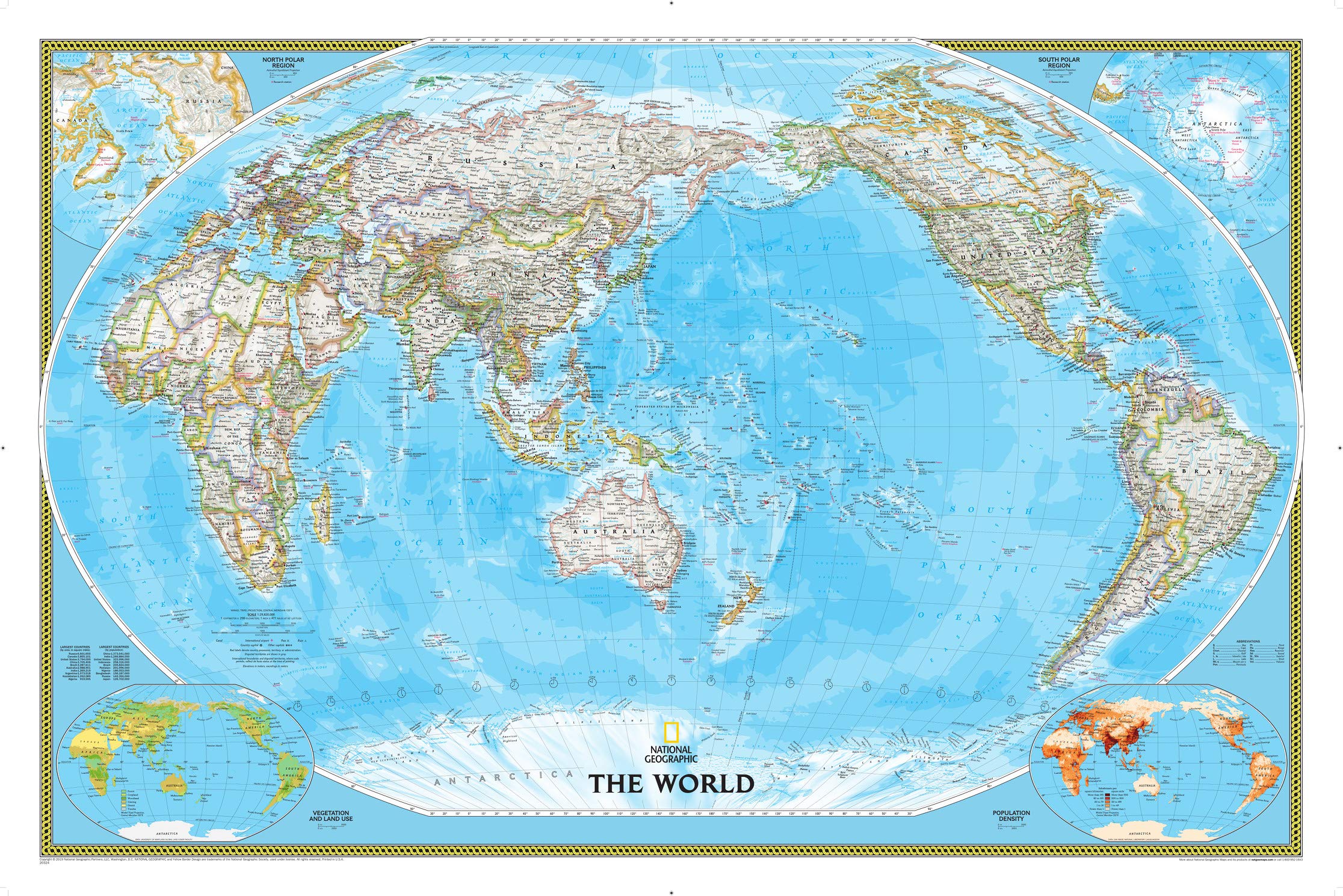
The National Geographic World Wall Map is an expertly crafted and meticulously designed reference map that serves as an authoritative guide to the world. Ideal for educational institutions, offices, and homes, this map enhances geographic knowledge and visual appeal in any setting.
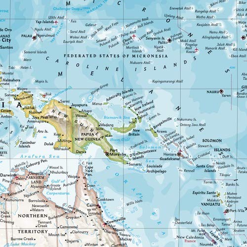
This world map features a signature classic style with a bright, easy-to-read color palette that includes vibrant blue oceans and colorful borders. It presents a unique Pacific-centered view that emphasizes the Pacific Rim, focusing on Asia, Oceania, and the vast expanse of the Pacific Ocean. The background incorporates subtle shaded relief to depict mountain ranges and valleys, providing depth and context to the geographical features represented.
Key Features:- Expertly researched using authoritative sources, ensuring accuracy and reliability.
- Displays clearly defined international boundaries, cities, and physical features.
- Thousands of place names are artfully placed for optimal legibility, even in densely populated regions.
- Up-to-date boundaries reflect current territorial control and international status.
- Utilizes the Winkel Tripel projection to minimize distortions, presenting an accurate depiction of land sizes.
- Corner inset maps illustrate vegetation, land use, population density, and polar regions.
- Encapsulated in durable 1.6 mil laminate, making it resistant to humidity changes and ideal for framing without glass.
This high-quality wall map is perfect for educators, students, travelers, and anyone interested in exploring global geography. Its durability and clarity make it an excellent addition to classrooms, offices, or home decor. By investing in the National Geographic World Wall Map, you not only gain a visually appealing piece of art but also a valuable educational resource that promotes global awareness and understanding.
⚠️ WARNING (California Proposition 65):
This product may contain chemicals known to the State of California to cause cancer, birth defects, or other reproductive harm.
For more information, please visit www.P65Warnings.ca.gov.
- Q: What are the dimensions of the National Geographic World Wall Map? A: The dimensions of the map are forty-six inches by thirty point five inches. This size makes it ideal for display and easy reference.
- Q: What material is the National Geographic World Wall Map made of? A: The map is laminated with a heavy-duty one point six mil laminate. This material enhances durability and resistance to humidity.
- Q: How many pages does the National Geographic World Wall Map have? A: The map consists of one page. It features a comprehensive view of the world in a single, detailed layout.
- Q: How do I hang or display the National Geographic World Wall Map? A: You can frame the laminated map without glass, making it lighter and more affordable. Simply choose a frame that fits forty-six inches by thirty point five inches.
- Q: Is the National Geographic World Wall Map suitable for classrooms? A: Yes, the map is suitable for classrooms. Its large size and clear details make it a valuable educational tool.
- Q: Can I use the National Geographic World Wall Map for teaching geography? A: Yes, it is an excellent resource for teaching geography. The map features up-to-date international boundaries and labeled physical features.
- Q: How should I clean the National Geographic World Wall Map? A: To clean the map, gently wipe it with a damp cloth. Avoid using harsh chemicals to preserve the laminate.
- Q: What is the best way to store the National Geographic World Wall Map? A: The best way to store the map is to keep it flat in a cool, dry place. Avoid rolling it to prevent damage to the laminated surface.
- Q: Is the National Geographic World Wall Map safe for children? A: Yes, the map is safe for children. It is made from durable materials and does not contain hazardous components.
- Q: How does the Pacific-centered view benefit users of the map? A: The Pacific-centered view accentuates the Pacific Rim, focusing on Asia and Oceania. This perspective is especially useful for studies related to these regions.
- Q: What unique features does the National Geographic World Wall Map offer? A: The map includes labeled mountain ranges, major water bodies, and thousands of place names. It also features inset maps of vegetation and population density.
- Q: How accurate are the place names on the National Geographic World Wall Map? A: The place names are highly accurate and researched using authoritative sources. They include conventional names and transliterations for non-Latin alphabets.
- Q: What projection is used for the National Geographic World Wall Map? A: The map is drawn in Winkel Tripel projection. This minimizes distortion and provides a more accurate representation of the world's geography.
- Q: Does the National Geographic World Wall Map include inset maps? A: Yes, the map features corner inset maps. These provide additional information on vegetation, land use, and population density.
- Q: What is the scale of the National Geographic World Wall Map? A: The scale of the map is one to twenty-nine million eight hundred twenty thousand. This scale allows for detailed representation of geographical features.