
Title
Needles District: Canyonlands National Park Map (National Geographic Trails Illustrated Map, 311)
Sold by Ergodebooks, an authorized reseller.
Returns accepted within 30 days | support@ergodebooks.com
Shipping Information
- Free Standard Shipping — United States only
- Processing Time: 3–5 business days
- Estimated Delivery: 6–10 business days after dispatch
- Double-boxed, fully insured & discreetly packaged
- Tracking number sent via email once dispatched
Returns & Refund
Returns accepted within 30 days of delivery.
Damaged or Defective Item
Free return shipping + replacement or full refund
Wrong Item Received
Free return shipping + replacement or full refund
Change of Mind
Return shipping at customer's expense · 25% restocking fee applies
Payment Option

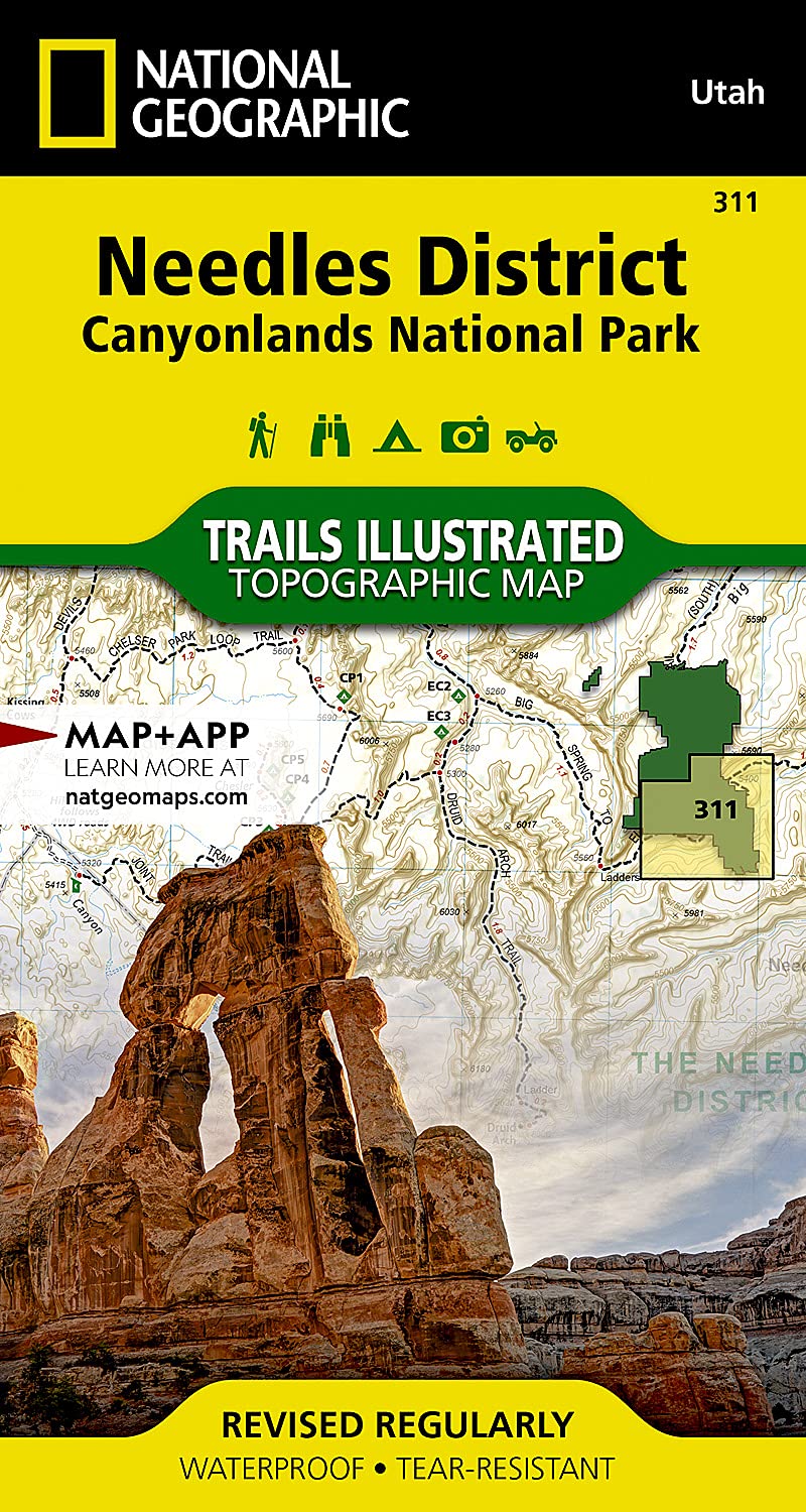
Waterproof Tearresistant Topographic Mapforming The Southeast Corner Of Canyonlands National Park, The Needles District Is Known For Its Colorful Sandstone Spires, Challenging Backcountry Roads And Extensive Trail System. Expertly Researched And Created In Partnership With The National Park Service, Bureau Of Land Management And Others, National Geographic'S Trails Illustrated Map Of Needles District Is A Complete Travel Guide To This Section Of The Park And Neighboring Dark Canyon And Butler Wash Wilderness Areas. The Provided Backcountry Regulations, Permit Information And Safety Tips Will Assist In Preparing For Your Adventure. The Hiking Trail And Backcountry Road Guides, With Route Descriptions And Mileage, Will Help You Chose The Most Suitable Path.Navigate The Area With Clearly Marked Trails And Backcountry Roads That Include Mileages Between Intersections. To Assist You, The Map Base Includes Contour Lines, Elevations, Shaded Relief And Water Features. River Mileage On The Colorado River Is Noted As Well, For Those Exploring By Boat. Mountain Bike Routes Are Marked With Their Degree Of Difficulty. Some Of The Many Recreation Features Are Campgrounds And Campsites, Scenic Overlooks, And Boat Launch Sites.Every Trails Illustrated Map Is Printed On Backcountry Tough Waterproof, Tearresistant Paper. A Full Utm Grid Is Printed On The Map To Aid With Gps Navigation.Other Features Found On This Map Include: Canyonlands National Park, Glen Canyon National Recreation Area, Green River. Map Scale = 1:35,000 Sheet Size = 25.5 X 37.75 Folded Size = 4 X 7.5
⚠️ WARNING (California Proposition 65):
This product may contain chemicals known to the State of California to cause cancer, birth defects, or other reproductive harm.
For more information, please visit www.P65Warnings.ca.gov.
- Q: What is the scale of the Needles District map? A: The scale of the Needles District map varies, with a general scale of 1:35,000.
- Q: Is the Needles District map waterproof? A: Yes, the Needles District map is printed on waterproof and tear-resistant paper.
- Q: What are the folded dimensions of the map? A: The folded dimensions of the Needles District map are 4.25 inches by 9.25 inches.
- Q: Who is the author of the Needles District map? A: The Needles District map is authored by National Geographic Maps - Trails Illustrated.
- Q: What features does the Needles District map include? A: The map includes topographic details, clearly marked trails, backcountry roads, contour lines, elevations, and water features.
- Q: Is the Needles District map suitable for mountain biking? A: Yes, the map marks mountain bike routes and indicates their degree of difficulty.
- Q: What additional information is provided on the Needles District map? A: The map provides backcountry regulations, permit information, safety tips, and a full UTM grid for GPS navigation.
- Q: What is the sheet size of the Needles District map? A: The sheet size of the Needles District map is 25.5 inches by 37.75 inches.
- Q: When was the Needles District map published? A: The Needles District map was published on January 1, 2023.
- Q: Can I use the Needles District map for exploring Utah? A: Yes, the Needles District map is recommended for exploring Utah, particularly the Canyonlands National Park area.