
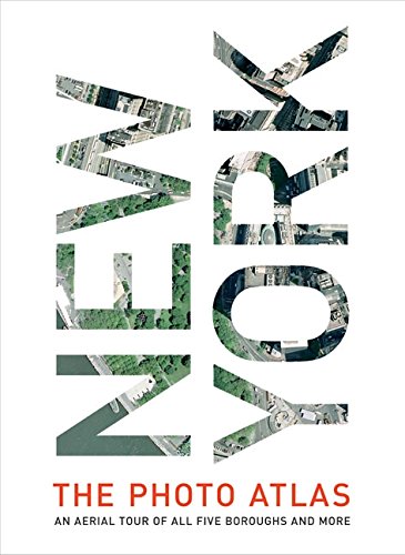
Title
New York: The Photo Atlas An Aerial Tour of All Five Boroughs and More,Used
Sold by Ergodebooks, an authorized reseller.
Returns accepted within 30 days | support@ergodebooks.com
Shipping Information
- Free Standard Shipping — United States only
- Processing Time: 3–5 business days
- Estimated Delivery: 6–10 business days after dispatch
- Double-boxed, fully insured & discreetly packaged
- Tracking number sent via email once dispatched
Returns & Refund
Returns accepted within 30 days of delivery.
Damaged or Defective Item
Free return shipping + replacement or full refund
Wrong Item Received
Free return shipping + replacement or full refund
Change of Mind
Return shipping at customer's expense · 25% restocking fee applies
Payment Option

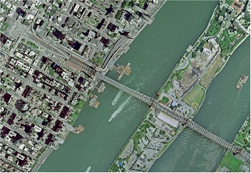
For those who think they know the streets of New York City like the back of their hand, think again. For those who don't know how to get around Gotham, here's a chance to get to know the city in all its glory. New York: The Photo Atlas combines exquisite aerial photography and detailed street atlas maps to provide a truly unique perspective of the city high above the concrete. The breadth of the area covered is stunning: All five boroughs are included, as well as several New York and New Jersey suburbs. Trace your bike route, find your apartment building, or take in the sights without leaving your living room. Even if you don't know New York well, you will find this book fascinating.The atlas is a breeze to use. The photography and the cartography share the same standard grid system so you can crossreference quickly between the two elements, and every street in the area shown is indexed for both types of maps. Both the photography and cartography are "map accurate": the photography has been geocorrected, a process that removes the distortions in the original aerial photography. Every street in NYC more than 40,000 in total has been indexed with two page numbers, one relating to the photos and the other relating to the cartography.Both native and honorary New Yorkers will be thrilled to own the groundbreaking New York: The Photo Atlas the most revealing New York atlas ever published.
⚠️ WARNING (California Proposition 65):
This product may contain chemicals known to the State of California to cause cancer, birth defects, or other reproductive harm.
For more information, please visit www.P65Warnings.ca.gov.
- Q: What are the dimensions of this book? A: The book measures ten point seventy-five inches in length, one point twenty-six inches in width, and fourteen point twenty-five inches in height.
- Q: How many pages does this atlas have? A: This atlas contains four hundred pages, providing a comprehensive view of New York City.
- Q: What type of binding does this book have? A: This book is bound in hardcover, ensuring durability for frequent use.
- Q: Who is the author of 'New York: The Photo Atlas'? A: The author of this atlas is Getmapping, known for their detailed aerial photography.
- Q: What unique features does this book offer? A: The atlas features exquisite aerial photography combined with detailed street atlas maps for a unique perspective of New York City.
- Q: How can I use this atlas to plan my bike route? A: You can trace your bike route using the indexed street maps and corresponding aerial photographs provided in the atlas.
- Q: Is this book suitable for tourists visiting New York? A: Yes, this book is perfect for tourists, as it provides a detailed understanding of all five boroughs and surrounding areas.
- Q: Can I find my apartment building in this atlas? A: Yes, every street in the area shown is indexed, making it easy to locate your apartment building.
- Q: How do I care for this hardcover atlas? A: To keep your atlas in good condition, store it in a dry place and avoid exposing it to excessive moisture.
- Q: Is the photography in this atlas accurate? A: Yes, the photography has been geo-corrected to ensure accuracy and remove distortions from the original images.
- Q: What if the book arrives damaged? A: If your book arrives damaged, you should contact customer support for assistance with returns or exchanges.
- Q: How do I clean the pages of this atlas? A: To clean the pages, gently wipe them with a dry microfiber cloth to avoid damage.
- Q: Is this atlas suitable for children? A: Yes, this atlas can be suitable for older children interested in geography and New York City.
- Q: What makes this atlas different from other New York guides? A: This atlas uniquely combines high-quality aerial photography with detailed maps, offering a perspective not found in standard guidebooks.
- Q: Can I use this atlas for educational purposes? A: Yes, educators can use this atlas as a resource for teaching about geography, urban planning, and photography.
- Q: Are there any safety warnings related to this book? A: There are no specific safety warnings for this book; it is suitable for general use.