
Title


Ozark National Scenic Riverways Map (National Geographic Trails Illustrated Map, 260),Used
Sold by Ergodebooks, an authorized reseller.
Returns accepted within 30 days | support@ergodebooks.com
Shipping Information
- Free Standard Shipping — United States only
- Processing Time: 3–5 business days
- Estimated Delivery: 6–10 business days after dispatch
- Double-boxed, fully insured & discreetly packaged
- Tracking number sent via email once dispatched
Returns & Refund
Returns accepted within 30 days of delivery.
Damaged or Defective Item
Free return shipping + replacement or full refund
Wrong Item Received
Free return shipping + replacement or full refund
Change of Mind
Return shipping at customer's expense · 25% restocking fee applies
Payment Option

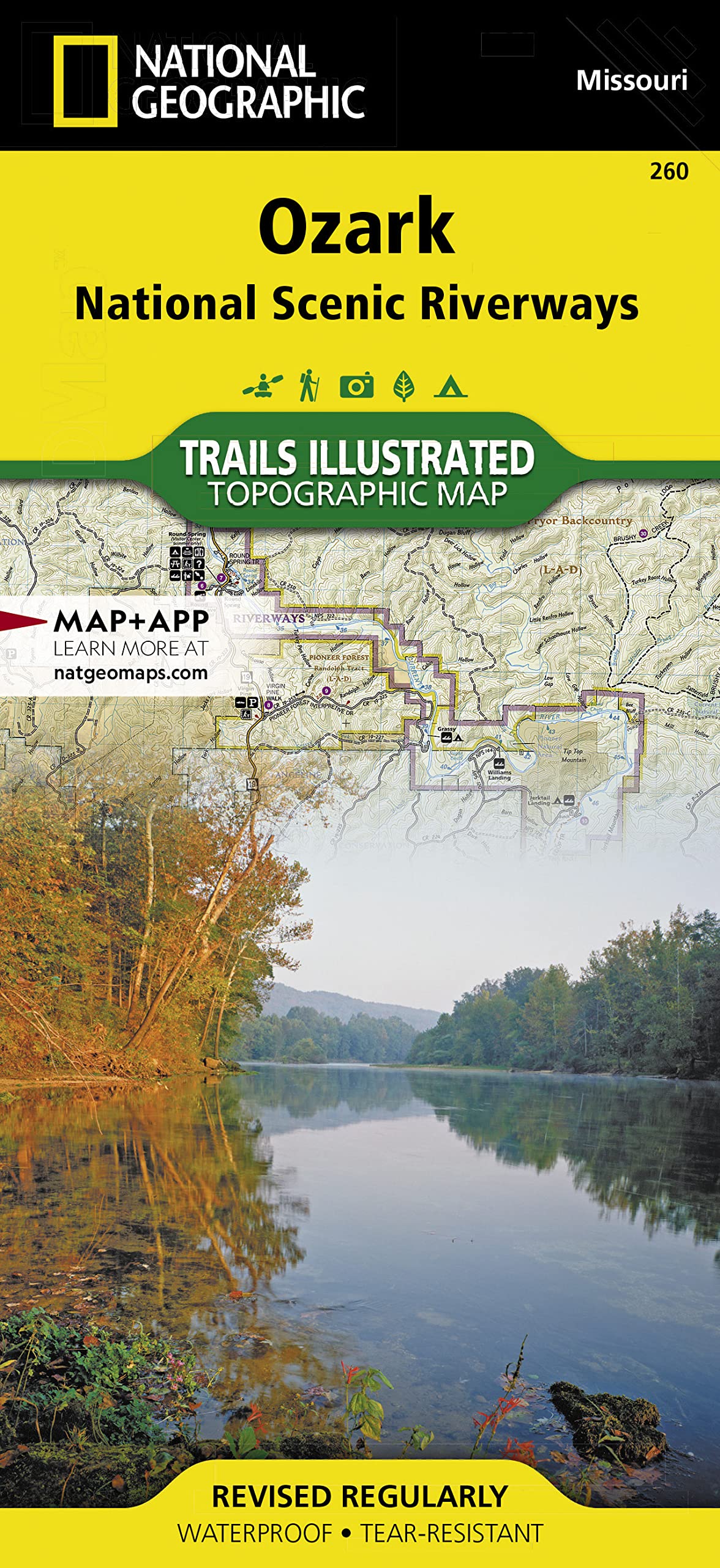
Waterproof TearResistant Topographic MapExplore the beauty and serenity of the Current and Jacks Fork rivers as they meander through southeastern Missouri's Ozark Mountains with National Geographic's Trails Illustrated map of Ozark National Scenic Riverways. Created in partnership with local land management agencies, this expertly researched map delivers unmatched detail and helpful information for experienced outdoor enthusiasts and casual visitors alike. Key areas of interest featured on this map include Montauk State Park, Roger Pryor Pioneer Backcountry, Pioneer Forest, Angeline Conservation Area, Mark Twain National Forest, Stegall Mountain, and Peck Ranch.This map can guide you off the beaten path and back again with miles of mapped trails including a portion of the Ozark Trail. Trail mileage between intersections will help you choose the path that's right for you. River mileage is noted as well, for those exploring by boat. Select trail summaries, safety tips, and information about many recreational opportunities available in the region including hiking, hunting, fishing, canoeing, horseback riding, spelunking, and more will help you make the most of your visit. The map base includes contour lines, shaded relief, and elevations for summits and passes. Many recreation features are noted as well, including campgrounds, boat launches, river access, trailheads, interpretive trails, shooting and archery ranges, interpretive drives, and points of interest.Every Trails Illustrated map is printed on "Backcountry Tough" waterproof, tearresistant paper. A full UTM grid is printed on the map to aid with GPS navigation.Other features found on this map include: Mark Twain National Forest, Ozark National Scenic Riverway, Spring Valley. Map Scale = 1:63,360 Sheet Size = 25.5" x 37.75" Folded Size = 4.25" x 9.25"
⚠️ WARNING (California Proposition 65):
This product may contain chemicals known to the State of California to cause cancer, birth defects, or other reproductive harm.
For more information, please visit www.P65Warnings.ca.gov.