
Title
Delorme Pennsylvania Atlas and Gazetteer - Comprehensive Road Map Guide for Outdoor Exploration
Sold by Ergodebooks, an authorized reseller.
Returns accepted within 30 days | support@ergodebooks.com
Shipping Information
- Free Standard Shipping — United States only
- Processing Time: 3–5 business days
- Estimated Delivery: 6–10 business days after dispatch
- Double-boxed, fully insured & discreetly packaged
- Tracking number sent via email once dispatched
Returns & Refund
Returns accepted within 30 days of delivery.
Damaged or Defective Item
Free return shipping + replacement or full refund
Wrong Item Received
Free return shipping + replacement or full refund
Change of Mind
Return shipping at customer's expense · 25% restocking fee applies
Payment Option

Delorme offers an exceptional travel planning resource designed for avid explorers and casual travelers alike. This platform is more than just a marketplace for DeLorme mapping software; it provides a comprehensive array of travel planning items, guidebooks, globes, maps, and atlases that cover every corner of the globe. Whether you're preparing for a road trip or seeking geography-related gifts, Delorme has the perfect solution.
The Delorme product range is thoughtfully curated to enhance your travel experiences. With an emphasis on user-friendly design, these products are ideal for anyone who wishes to navigate new territories with confidence. The availability of various travel-related items ensures that every traveler can find exactly what they need, from detailed maps to informative guidebooks.
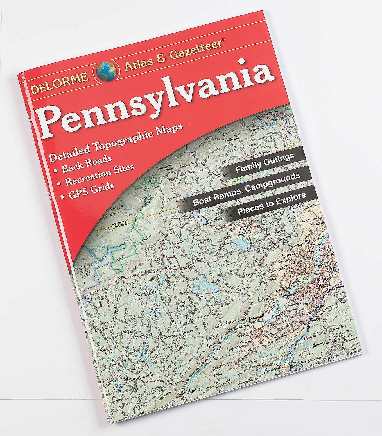
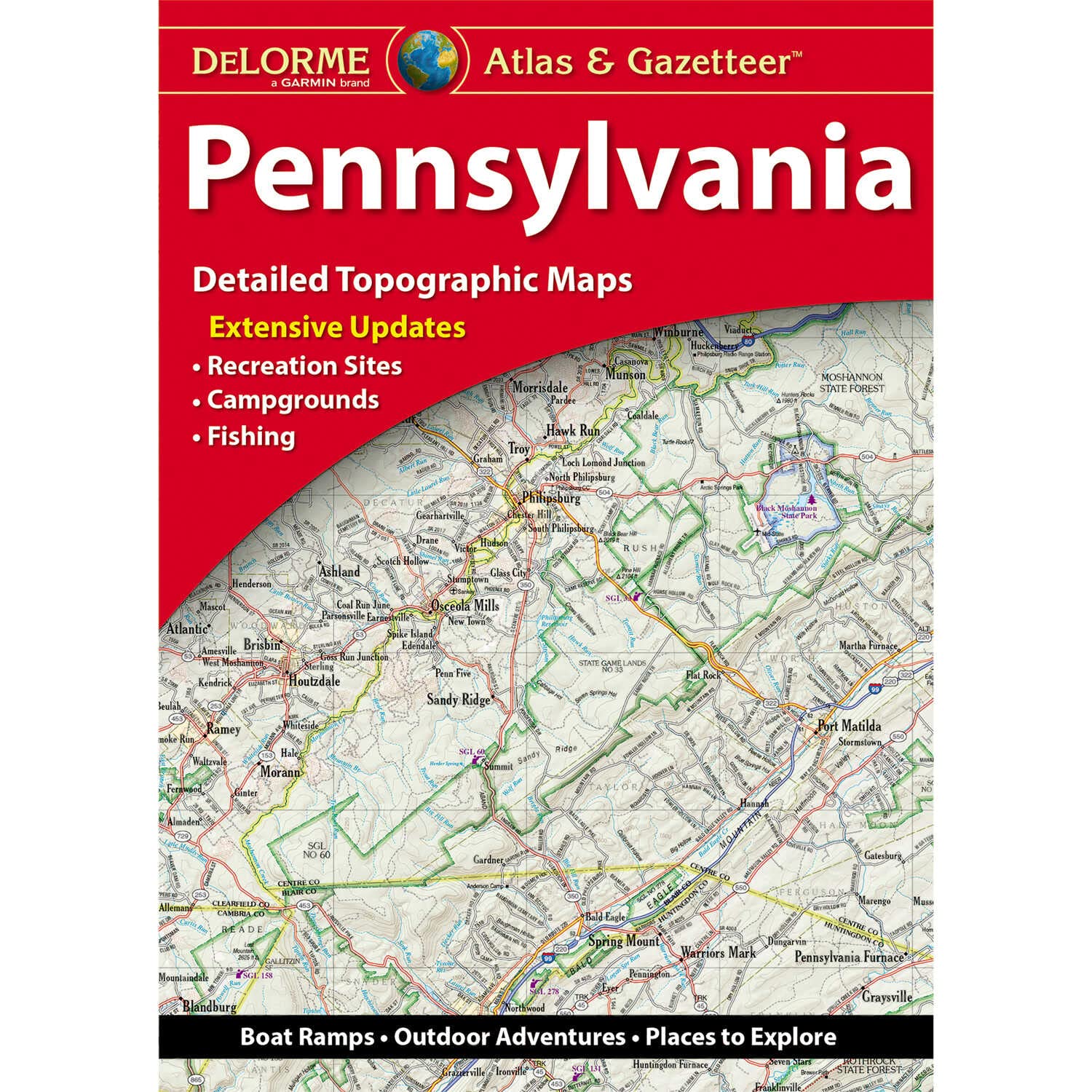
Key Features:- Includes back roads, elevation contours, and recreational areas for comprehensive navigation.
- Paperback format allows for easy carrying and storage, perfect for on-the-go planners.
- Maps are easy to read and use, ensuring clarity in navigation.
- Rich assortment of geography-related gifts suitable for occasions like graduation and holidays.
- Extensive coverage with products available for every state and worldwide destinations.
- Ideal for both seasoned travelers and those new to exploration.
- High-quality materials ensure durability and longevity of the maps and guides.
Delorme products are perfect for anyone looking to enhance their travel planning experience. They cater to students, professionals, and outdoor enthusiasts who value accurate and detailed maps. With Delorme, travelers can embark on their journeys well-prepared, equipped with the knowledge and tools necessary to explore the world confidently. Whether you're seeking to navigate remote back roads or find the perfect gift for a travel lover, Delorme is your go-to resource for travel planning essentials.
⚠️ WARNING (California Proposition 65):
This product may contain chemicals known to the State of California to cause cancer, birth defects, or other reproductive harm.
For more information, please visit www.P65Warnings.ca.gov.
- Q: What are the dimensions of the Pennsylvania Atlas and Gazetteer? A: The Pennsylvania Atlas and Gazetteer measures eleven inches in length, fifteen point seventy-five inches in height, and zero point twenty-five inches in width. This size makes it convenient for travel and easy to handle.
- Q: How many pages does the Pennsylvania Atlas and Gazetteer have? A: The Pennsylvania Atlas and Gazetteer contains eighty-eight pages. This comprehensive content provides detailed maps and travel information for the state.
- Q: What is the binding type of this atlas? A: The binding type of the Pennsylvania Atlas and Gazetteer is map. This allows for easy use and durability during travel.
- Q: Is the Pennsylvania Atlas and Gazetteer suitable for outdoor use? A: Yes, the Pennsylvania Atlas and Gazetteer is designed for outdoor use. It includes features like back roads and recreational areas, making it ideal for travelers.
- Q: How do I best utilize the Pennsylvania Atlas and Gazetteer for my travels? A: To utilize the Pennsylvania Atlas and Gazetteer effectively, familiarize yourself with the map layout and key features. This will help you navigate and plan your routes.
- Q: Is this atlas user-friendly for beginners? A: Yes, the Pennsylvania Atlas and Gazetteer is user-friendly and easy to read. Its layout is designed for travelers of all experience levels.
- Q: How should I store the Pennsylvania Atlas and Gazetteer? A: To keep the Pennsylvania Atlas and Gazetteer in good condition, store it flat in a cool, dry place. Avoid exposure to moisture to preserve its quality.
- Q: Can I clean the Pennsylvania Atlas and Gazetteer? A: Yes, you can clean the Pennsylvania Atlas and Gazetteer. Use a soft, dry cloth to gently wipe the cover and pages, avoiding any liquid cleaners.
- Q: Is the Pennsylvania Atlas and Gazetteer safe for children? A: Yes, the Pennsylvania Atlas and Gazetteer is safe for children. However, parental supervision is recommended for younger children when using maps outdoors.
- Q: What age group is the Pennsylvania Atlas and Gazetteer suitable for? A: The Pennsylvania Atlas and Gazetteer is suitable for all ages. It can be a valuable resource for families planning trips and educational purposes.
- Q: How does the Pennsylvania Atlas and Gazetteer compare to other atlases? A: The Pennsylvania Atlas and Gazetteer offers specific features like elevation contours and recreational areas, making it more detailed than standard atlases.
- Q: Is this atlas good for detailed trip planning? A: Yes, the Pennsylvania Atlas and Gazetteer is excellent for detailed trip planning. It provides comprehensive maps that cover various travel needs.
- Q: What if the Pennsylvania Atlas and Gazetteer arrives damaged? A: If the Pennsylvania Atlas and Gazetteer arrives damaged, you should contact customer support for a replacement or refund. Keep the original packaging for reference.
- Q: Can I return the Pennsylvania Atlas and Gazetteer if I don't like it? A: Yes, you can return the Pennsylvania Atlas and Gazetteer if you are not satisfied. Check the return policy for specific terms and conditions.
- Q: Does the Pennsylvania Atlas and Gazetteer include digital content? A: No, the Pennsylvania Atlas and Gazetteer does not include digital content. It is a printed map resource designed for physical use.
- Q: What features make the Pennsylvania Atlas and Gazetteer unique? A: The Pennsylvania Atlas and Gazetteer includes unique features like detailed back roads and elevation contours, which are not commonly found in other atlases.