
Title
Rand Mcnally Central United States: Regional Map
Sold by Ergodebooks, an authorized reseller.
Returns accepted within 30 days | support@ergodebooks.com
Shipping Information
- Free Standard Shipping — United States only
- Processing Time: 3–5 business days
- Estimated Delivery: 6–10 business days after dispatch
- Double-boxed, fully insured & discreetly packaged
- Tracking number sent via email once dispatched
Returns & Refund
Returns accepted within 30 days of delivery.
Damaged or Defective Item
Free return shipping + replacement or full refund
Wrong Item Received
Free return shipping + replacement or full refund
Change of Mind
Return shipping at customer's expense · 25% restocking fee applies
Payment Option

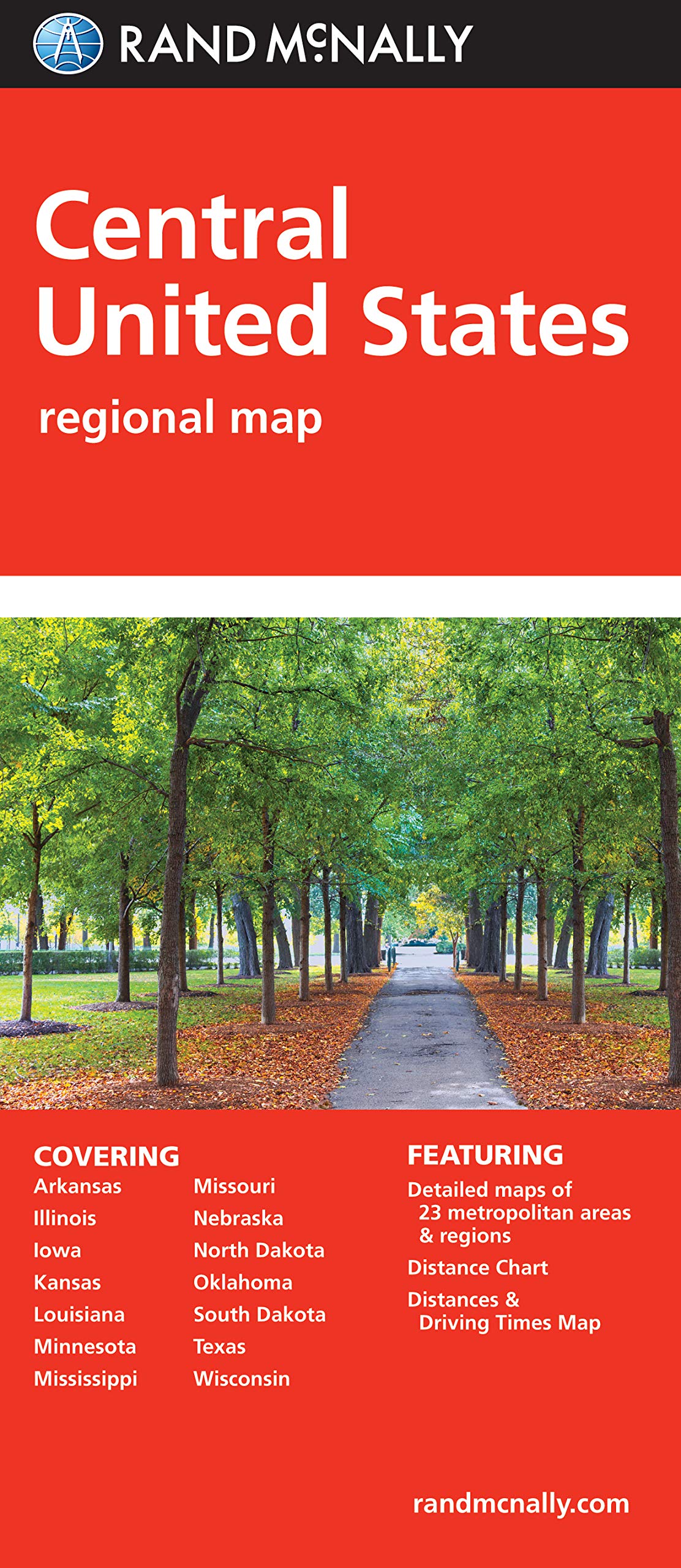
Rand Mcnally'S Folded Map Featuring The Central United States Is A Musthave For Anyone Traveling In And Around This Part Of The Country, Offering Unbeatable Accuracy And Reliability At A Great Price. Our Trusted Cartography Shows All Interstate, State, And County Highways, Along With Clearly Indicated Points Of Interest, Airports, County Boundaries, And More.You'Ll See Why Rand Mcnally Folded Maps Have Been The Trusted Standard For Years.Regularly Updated, Fullcolor Mapsclearly Labeled Interstate, U.S., State, And County Highwaysdetail Maps Of Major Cities, A Mileage Chart, And A Mileages & Driving Times Mapindications Of Parks, Points Of Interest, Airports, County Boundaries, And Moreeasytouse Legenddetailed Indexconvenient Folded Sizecoverage Areastates Covered: Arkansas, Illinois, Iowa, Kansas, Louisiana, Minnesota, Mississippi, Missouri, Nebraska, North Dakota, Oklahoma, South Dakota, Texas, And Wisconsinproduct Detailsmeasures 9.5 X 4.125 And Folds Out To 40 X 28.
⚠️ WARNING (California Proposition 65):
This product may contain chemicals known to the State of California to cause cancer, birth defects, or other reproductive harm.
For more information, please visit www.P65Warnings.ca.gov.
- Q: What are the dimensions of the Rand McNally Central United States map? A: The map measures nine and a half inches by four and one eighth inches when folded and expands to forty inches by twenty eight inches when unfolded.
- Q: How many pages does this map have? A: The Rand McNally Central United States map has one page.
- Q: What type of binding does this map use? A: This map features a folded binding, making it easy to carry and store.
- Q: How do I use the Rand McNally Central United States map? A: To use the map, simply unfold it to view the detailed roadways, points of interest, and coverage areas of the Central United States.
- Q: Is this map suitable for planning a road trip? A: Yes, this map is excellent for planning a road trip, providing accurate roadways and points of interest across multiple states.
- Q: Can children use this map? A: Yes, children can use this map under adult supervision, as it is designed for general travel and navigation.
- Q: How should I store the Rand McNally Central United States map? A: Store the map in a cool, dry place to prevent damage. Keeping it folded in a map pouch can also help protect it.
- Q: What should I do if the map gets wet? A: If the map gets wet, gently dry it with a towel and allow it to air dry completely before folding it again.
- Q: Is the map durable? A: Yes, the Rand McNally map is made from quality materials designed to withstand regular use while traveling.
- Q: How does this map compare to digital maps? A: This map provides a reliable backup to digital maps, especially in areas with limited internet connectivity.
- Q: Is this map suitable for professional drivers? A: Yes, professional drivers can benefit from this map's detailed roadways and points of interest, making it a useful navigation tool.
- Q: What states are covered by this map? A: The map covers the states of Arkansas, Illinois, Iowa, Kansas, Louisiana, Minnesota, Mississippi, Missouri, Nebraska, North Dakota, Oklahoma, South Dakota, Texas, and Wisconsin.
- Q: Can I use this map for hiking? A: While primarily for road travel, the map indicates parks and points of interest, making it useful for planning hikes in those areas.
- Q: What features does this map include? A: The map includes full-color updates, clearly labeled highways, detail maps of major cities, and an easy-to-use legend.
- Q: What if my map arrives damaged? A: If your map arrives damaged, contact customer support for options regarding returns or exchanges.