
Title
Rand Mcnally Easy To Read Folded Map: North Carolina State Map
Sold by Ergodebooks, an authorized reseller.
Returns accepted within 30 days | support@ergodebooks.com
Shipping Information
- Free Standard Shipping — United States only
- Processing Time: 3–5 business days
- Estimated Delivery: 6–10 business days after dispatch
- Double-boxed, fully insured & discreetly packaged
- Tracking number sent via email once dispatched
Returns & Refund
Returns accepted within 30 days of delivery.
Damaged or Defective Item
Free return shipping + replacement or full refund
Wrong Item Received
Free return shipping + replacement or full refund
Change of Mind
Return shipping at customer's expense · 25% restocking fee applies
Payment Option

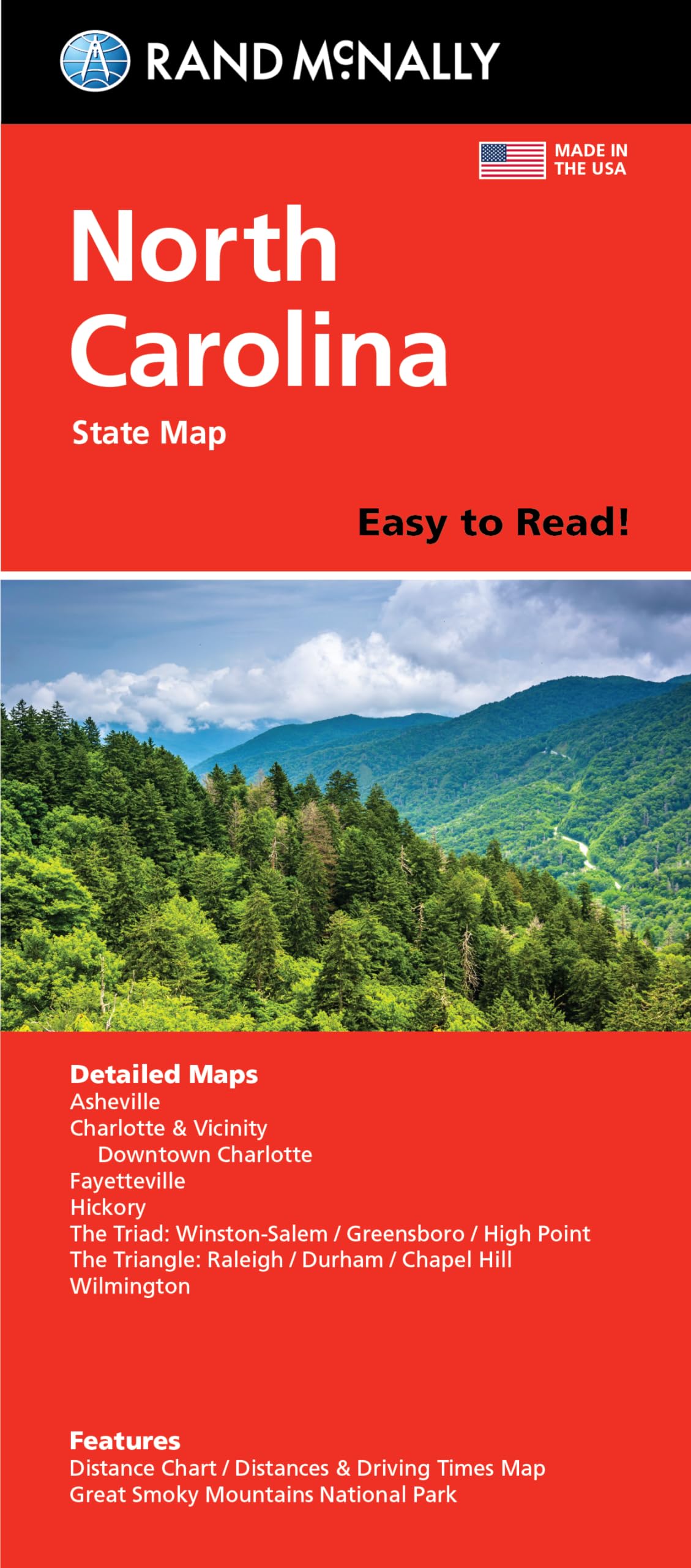
Rand Mcnally'S Folded Map For North Carolina Is A Musthave For Anyone Traveling In Or Through The State, Offering Unbeatable Accuracy And Reliability At A Great Price. Our Trusted Cartography Shows All Interstate, U.S., State, And County Highways And Much More. Points Of Interest. State Park Chart. State Mileage Chart. Driving Times Map. Ontheroad Toolbox. Visitor Center Information. Climate Data. State Facts & Symbols. Easytouse Legend. Detailed Indexed. Coverage Area: Detailed Maps Include Asheville, Charlotte, Fayetteville, Gastonia, Great Smoky Mountains National Park, Raleigh/Durham/Chapel Hill, Wilmington, Winstonsalem/Greensboro/High Point. Product Details: Measures 9.0 X 4.125 And Folds Out To 25.5 X 36.75
⚠️ WARNING (California Proposition 65):
This product may contain chemicals known to the State of California to cause cancer, birth defects, or other reproductive harm.
For more information, please visit www.P65Warnings.ca.gov.
- Q: What are the dimensions of the Rand McNally North Carolina State Map? A: The map measures nine inches by four point one two five inches when folded and opens to twenty five point five inches by thirty six point seven five inches.
- Q: How many pages does the Rand McNally North Carolina State Map have? A: The map consists of one page, providing a comprehensive overview of the state of North Carolina.
- Q: What type of binding does the Rand McNally North Carolina State Map use? A: The map is bound as a folded map, allowing for easy handling and storage.
- Q: How can I use the Rand McNally North Carolina State Map? A: You can use the map for navigation while traveling, as it includes detailed information on highways, points of interest, and state parks.
- Q: Is the Rand McNally North Carolina State Map suitable for road trips? A: Yes, this map is perfect for road trips, offering driving times and an on-the-road toolbox for travelers.
- Q: Can I find visitor center information on the Rand McNally North Carolina State Map? A: Yes, the map includes visitor center information to help you find resources and assistance during your travels.
- Q: How should I store the Rand McNally North Carolina State Map? A: Store the map in a cool, dry place to prevent damage, and keep it folded to maintain its condition.
- Q: Are there any special care instructions for the Rand McNally North Carolina State Map? A: There are no specific care instructions, but avoid exposing the map to moisture to preserve its quality.
- Q: Is the Rand McNally North Carolina State Map safe for children? A: Yes, the map is safe for children and can be a fun resource for family trips and learning about the state.
- Q: How does the Rand McNally North Carolina State Map compare to digital maps? A: The folded map offers reliable, offline navigation, which can be beneficial in areas with poor cell service compared to digital maps.
- Q: What features are included in the Rand McNally North Carolina State Map? A: Features include points of interest, a state park chart, mileage chart, driving times, and climate data.
- Q: What if my Rand McNally North Carolina State Map arrives damaged? A: If the map arrives damaged, you should contact the retailer for return or exchange options.
- Q: Is there a warranty available for the Rand McNally North Carolina State Map? A: Typically, maps do not come with a warranty, but check with the retailer for specific return policies.
- Q: Does the Rand McNally North Carolina State Map include climate data? A: Yes, the map provides climate data, which can be helpful for planning your visit to North Carolina.
- Q: What types of information can I expect to find on the Rand McNally North Carolina State Map? A: You can find information on highways, points of interest, state parks, and a detailed indexed legend.