
Title
Santa Fe, Bandelier & Los Alamos Trail Map 2nd Edition,New
Sold by Ergodebooks, an authorized reseller.
Returns accepted within 30 days | support@ergodebooks.com
Shipping Information
- Free Standard Shipping — United States only
- Processing Time: 3–5 business days
- Estimated Delivery: 6–10 business days after dispatch
- Double-boxed, fully insured & discreetly packaged
- Tracking number sent via email once dispatched
Returns & Refund
Returns accepted within 30 days of delivery.
Damaged or Defective Item
Free return shipping + replacement or full refund
Wrong Item Received
Free return shipping + replacement or full refund
Change of Mind
Return shipping at customer's expense · 25% restocking fee applies
Payment Option

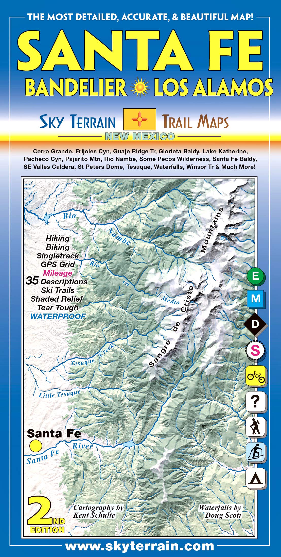
Very detailed and beautiful topographic trail map covers the area from historic downtown Santa Fe up to the high mountains of the Sangre de Cristo. The second side shows Bandelier National Mounument, including the famous cliff dwellings and the perfect canyons; and Los Alamos as well as the Jemez Mountains and a chunk of the Valle Caldera National Preserve. Custom shaded relief reveals the terrain in a new light. Trails are rated, trailheads & singletrack marked, mileage shown. UTM lines for GPS. Roads rated for biking. Informative trail descriptions included. Updated, and numerous waterfalls added. Printed on waterproof paper; folds to 4 by 8 inches.
⚠️ WARNING (California Proposition 65):
This product may contain chemicals known to the State of California to cause cancer, birth defects, or other reproductive harm.
For more information, please visit www.P65Warnings.ca.gov.
- Q: What areas does the Santa Fe, Bandelier & Los Alamos Trail Map cover? A: The map covers the area from historic downtown Santa Fe to the high mountains of the Sangre de Cristo, including Bandelier National Monument, Los Alamos, the Jemez Mountains, and parts of the Valle Caldera National Preserve.
- Q: Is the Santa Fe, Bandelier & Los Alamos Trail Map waterproof? A: Yes, the map is printed on waterproof paper, making it durable and suitable for outdoor use in various weather conditions.
- Q: What features are included on the trail map? A: The map includes detailed topographic features, rated trails, marked trailheads and singletrack, mileage information, UTM lines for GPS, biking-rated roads, and informative trail descriptions.
- Q: What is the size of the map when folded? A: When folded, the map measures 4 by 8 inches, making it compact and easy to carry.
- Q: Who is the author of the Santa Fe, Bandelier & Los Alamos Trail Map? A: The map is authored by Sky Terrain.
- Q: When was the second edition of the map published? A: The second edition of the Santa Fe, Bandelier & Los Alamos Trail Map was published on September 7, 2012.
- Q: Are there any new features in the second edition? A: Yes, the second edition includes updated information and numerous waterfalls that have been added to enhance the trail experience.
- Q: Can I use this map for hiking and biking? A: Yes, the map is designed for both hiking and biking, as it includes ratings for trails and roads suitable for biking.
- Q: Does the map provide information about trail conditions? A: Yes, the map includes informative trail descriptions that can help users understand the conditions and features of each trail.
- Q: What type of binding does the Santa Fe, Bandelier & Los Alamos Trail Map have? A: The map is bound as a traditional map, allowing for easy unfolding and reference during outdoor activities.