
Title
Southern England Regional AZ Road Atlas,Used
Sold by Ergodebooks, an authorized reseller.
Returns accepted within 30 days | support@ergodebooks.com
Shipping Information
- Free Standard Shipping — United States only
- Processing Time: 3–5 business days
- Estimated Delivery: 6–10 business days after dispatch
- Double-boxed, fully insured & discreetly packaged
- Tracking number sent via email once dispatched
Returns & Refund
Returns accepted within 30 days of delivery.
Damaged or Defective Item
Free return shipping + replacement or full refund
Wrong Item Received
Free return shipping + replacement or full refund
Change of Mind
Return shipping at customer's expense · 25% restocking fee applies
Payment Option

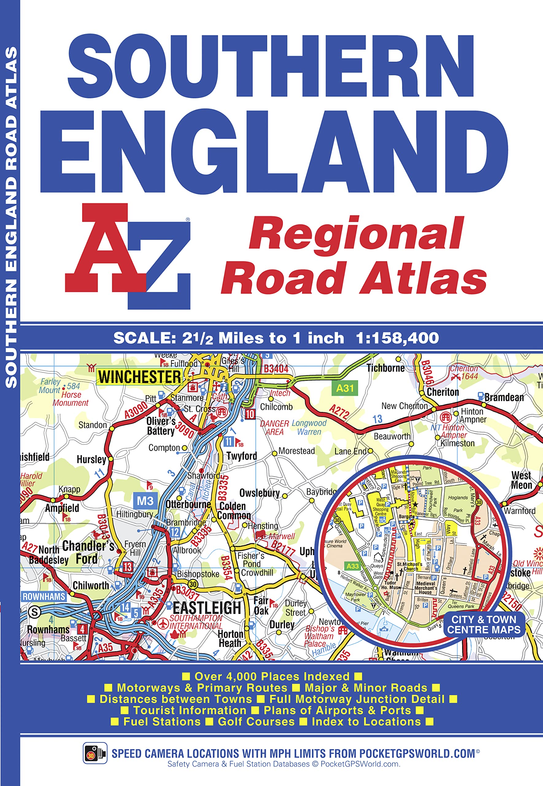
This AZ map of Southern England is a full colour regional road atlas featuring 39 pages of continuous road mapping that covers an area extending to:CardiffNewportBristolSwindonReadingSloughGuildfordLittlehamptonPortsmouthIsle of WightBournemouthWeymouthSidmouthTauntonWestonSuperMareThis Southern England Road Atlas is shown at a clear 2.5 miles to 1 inch scale (1.58 km to 1 cm) and includes the following features:Motorways open with full junction detail, motorways under construction and proposed, service areas, primary routes and destinations, A & B roads, selected minor roads, gradients 1:5 and steeper, tolls, mileages, county boundaries, spot heights and hill shadingSelected safety camera locations with their maximum speed limitsSelected fuel stationsNational Park boundariesSelected places of interest, tourist information centres and golf coursesAlso included are 15 city, town, airport or port plans for:BathBournemouthBristolCardiffGuildfordPortsmouthReadingSalisburySouthamptonSwindonTauntonWinchesterWindsorLondon Heathrow AirportPoole PortThe index section lists cities, towns, villages, hamlets and locations covered by this atlas.
⚠️ WARNING (California Proposition 65):
This product may contain chemicals known to the State of California to cause cancer, birth defects, or other reproductive harm.
For more information, please visit www.P65Warnings.ca.gov.