
Title
Topographic Recreational Map of Western Montana,Used
Processing time: 1-3 days
US Orders Ships in: 3-5 days
International Orders Ships in: 8-12 days
Return Policy: 15-days return on defective items
Payment Option

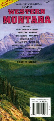
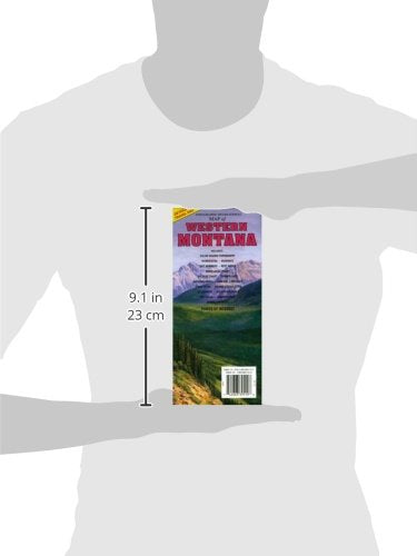
Topographic full color map of Western Montana is scaled at 1" = 12.5 miles. Elevation contours each 1,000 feet (color shaded each 2,000 feet at higher elevations) portray the general geography. Also shown are national forests, wilderness areas, campgrounds, parks, state game and fish areas, ski areas, mining districts, points of interest, and more. More roads are shown than on typical highway maps. Much printed information is also included. Maps fold to approximately 4 1/8" x 9".
⚠️ WARNING (California Proposition 65):
This product may contain chemicals known to the State of California to cause cancer, birth defects, or other reproductive harm.
For more information, please visit www.P65Warnings.ca.gov.
- Q: What are the dimensions of the Topographic Recreational Map of Western Montana? A: The map folds to approximately four and one eighth inches by nine inches. This compact size makes it easy to carry and store.
- Q: What type of binding does the map have? A: The binding of the map is specifically designed for durability and ease of use. It is a standard map binding that allows for convenient folding.
- Q: Who is the author of this topographic map? A: The author of the Topographic Recreational Map of Western Montana is GTR Mapping. They are known for their detailed and accurate mapping.
- Q: How do I use the Topographic Recreational Map? A: To use the map, unfold it and locate your area of interest. The elevation contours and points of interest provide valuable information for outdoor activities.
- Q: Is this map suitable for beginners in outdoor activities? A: Yes, the map is suitable for beginners. It clearly indicates national forests, campgrounds, and parks, making it easy to navigate.
- Q: Can I use this map for hiking and camping? A: Yes, the map is ideal for hiking and camping. It highlights trails, campgrounds, and other outdoor facilities for recreational use.
- Q: How do I keep the map in good condition? A: To keep the map in good condition, store it flat or folded in a dry place. Avoid exposure to moisture to prevent damage.
- Q: Is the map waterproof? A: No, the map is not waterproof. It is important to protect it from water and moisture to maintain its condition.
- Q: How should I clean the map if it gets dirty? A: To clean the map, gently wipe it with a dry cloth. Avoid using water or cleaning solutions that could damage the paper.
- Q: How does this map compare to standard highway maps? A: The Topographic Recreational Map offers more detailed information than standard highway maps. It includes elevation contours and specific recreational areas.
- Q: Is this map good for both casual and serious outdoor enthusiasts? A: Yes, the map is suitable for both casual and serious outdoor enthusiasts. It provides valuable information for various levels of exploration.
- Q: Can I use this map for planning a road trip? A: Yes, the map can assist in planning a road trip. It highlights scenic routes and points of interest in Western Montana.
- Q: What if my map arrives damaged? A: If your map arrives damaged, contact customer support for a replacement. Ensure you have your order details ready for a smooth process.
- Q: Is there a warranty for this map? A: There is no specific warranty for the map. However, if it is defective upon arrival, you may be eligible for a return or exchange.
- Q: How can I ensure I have the latest version of the map? A: To ensure you have the latest version, check the publication date on the map or contact the manufacturer for updates.
- Q: Can I return the map if I change my mind? A: Yes, you can return the map if you change your mind. Please refer to the return policy for specific instructions and time limits.