
Title
United States, Rocky Mountains Map (National Geographic Adventure Map, 3120),New
Sold by Ergodebooks, an authorized reseller.
Returns accepted within 30 days | support@ergodebooks.com
Shipping Information
- Free Standard Shipping — United States only
- Processing Time: 3–5 business days
- Estimated Delivery: 6–10 business days after dispatch
- Double-boxed, fully insured & discreetly packaged
- Tracking number sent via email once dispatched
Returns & Refund
Returns accepted within 30 days of delivery.
Damaged or Defective Item
Free return shipping + replacement or full refund
Wrong Item Received
Free return shipping + replacement or full refund
Change of Mind
Return shipping at customer's expense · 25% restocking fee applies
Payment Option

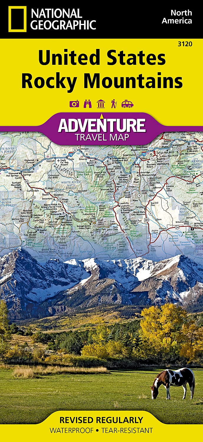
? Waterproof ? TearResistant ? Travel MapThere are few nations as vast and spectacularly diverse as the United States of America. From the Atlantic to the Pacific, 'America the Beautiful' offers boundless destinations and experiences for travelers seeking outdoor adventures, small town delights, or the excitement of urban culture.The United States Rocky Mountains Adventure Map will guide you through one of the most rugged and scenic regions in North America. Colorado, Utah, Wyoming, and Montana contain Yellowstone, Grand Teton, Glacier, Zion, Arches, Capitol Reef, Canyonlands, Mesa Verde, and Rocky Mountain National Parks along with dozens of magnificent National Monuments, Forests, and Wilderness Areas, the Continental Divide, and America's greatest skiing, rafting, and climbing destinations. The map includes the cities of Denver, Salt Lake City, and Missoula, and Cheyenne and covers nearly all of Idaho. There is simply no better map for exploring the Rocky Mountains of the United States.National Geographic's US Adventure Maps provide the most authoritative and convenient travel maps available to plan and guide your USA Adventure. Each map delivers the perfect combination of detail and perspective, highlighting travel routes, topography, and points of interest for those venturing beyond the city centers. Whether you're on a classic American road trip or planning a grand tour to visit several cities or national parks, these maps offer the ultimate geographic resource as only National Geographic can provide.Every Adventure Map is printed on durable synthetic paper, making them waterproof, tearresistant and tough capable of withstanding the rigors of international travel. Map Scale = 1:1,300,000 Sheet Size = 25.5' x 37.75' Folded Size = 4.25' x 9.25'
⚠️ WARNING (California Proposition 65):
This product may contain chemicals known to the State of California to cause cancer, birth defects, or other reproductive harm.
For more information, please visit www.P65Warnings.ca.gov.
- Q: What is the scale of the United States, Rocky Mountains Map? A: The scale of the United States, Rocky Mountains Map is 1:1,300,000.
- Q: What are the dimensions of the map when folded? A: When folded, the map measures 4.25 inches by 9.25 inches.
- Q: Is this map waterproof and tear-resistant? A: Yes, the map is printed on durable synthetic paper, making it both waterproof and tear-resistant.
- Q: Which states are covered by this map? A: The map covers Colorado, Utah, Wyoming, Montana, and nearly all of Idaho.
- Q: What outdoor destinations are highlighted on the map? A: The map highlights major national parks including Yellowstone, Grand Teton, Glacier, Zion, Arches, Capitol Reef, Canyonlands, Mesa Verde, and Rocky Mountain National Park.
- Q: Who is the author of this adventure map? A: The United States, Rocky Mountains Map is authored by National Geographic Maps - Adventure.
- Q: When was the map published? A: The map was published on January 1, 2022.
- Q: What is the sheet size of the map? A: The sheet size of the map is 25.5 inches by 37.75 inches.
- Q: Is this map suitable for international travel? A: Yes, the map is designed to withstand the rigors of international travel due to its durable material.
- Q: What type of binding does this map have? A: The map is bound as a traditional map, allowing for easy unfolding and use.